Displaying 141 - 150 of 305
![Hurricane Isaias traveling northwest between Cuba and the Bahamas on Friday, July 31, 2020, as seen from the International Space Station. Credits: NASA/Astronaut Col. Doug Hurley](/sites/default/files/styles/lis/public/2020-08/isaias_astronaut.jpg.webp?itok=6vi0Xof4)
![](/sites/default/files/styles/lis/public/images/develop-legacy/2018/summer/images/2018Sum_LaRC_ColombiaEco.jpg.webp?itok=52ywG06n)
Topic
Colombia contains a variety of endemic species, making it one of the most biodiverse regions in the world. Due to a recent peace treaty between...
Topic
SPARROW is widely used throughout the United States for long term, steady state water quality analysis. However, users are increasingly asking for a dynamic version...
![](/sites/default/files/styles/lis/public/images/develop-legacy/2019/summer/images/2019Sum_MSFC_ConecuhNationalForestEco_WebsiteImage_2.jpg.webp?itok=X9VxH89Y)
Topic
The gopher frog (Lithobates capito) is an endangered species facing extinction within the next century due to loss and alteration of its habitat. With limited...
![](/sites/default/files/styles/lis/public/images/develop-legacy/2020/summer/images/2020Sum_CO_FishersPeakEco_WebsiteImage.jpg.webp?itok=43PBiYuq)
Topic
Fisher’s Peak is a 77.5 km2 property southeast of Trinidad, Colorado that is planned to become Colorado’s newest state park. The area has experienced limited...
![](/sites/default/files/styles/lis/public/sao-jorge-VIIRS-March-28-2022.jpg.webp?itok=0GwyFs8B)
Topic
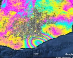
When an earthquake occurs, seismic data provides an initial estimate of magnitude and location. However, for large earthquakes, we can improve our situational awareness once...
![This map produced from JAXA ALOS-2 satellite data shows surface displacement caused by the 7.4 magnitude earthquake in Mexico. Credit: NASA, JAXA Sang-Wan Kim, Batu Osmanoglu, and Min-Jeong Jo](/sites/default/files/styles/lis/public/2020-06/ALOS-2-deformation-map-mexico-earthquake-2020.jpg.webp?itok=3Pmvha3y)