Displaying 21 - 30 of 64
![A remote sensing scene of wildfire extent in the Black Hills in South Dakota](/sites/default/files/styles/lis/public/2022-11/2022Sum_CO_BlackHillsWildfire_WebsiteImage.jpg.webp?itok=3SvKdSkf)
Black Hills Wildfires (Summer 2022) Team: Casey Menick (Project Lead), Haley Stuckmeyer, Heidi Rogers, Yeshey Seldon Summary: The 2000 Jasper Fire in the Black Hills...
![Median June composite of daily evapotranspiration from ECOSTRESS before the start of the Bootleg Fire on July 6th, 2021. Evapotranspiration is shown in millimeters per day across Klamath and Lake counties in Oregon, with dark blue indicating areas with higher evapotranspiration and light tan indicating lower evapotranspiration. Evapotranspiration is an indicator of vegetation moisture and can aid wildfire modeling by locating areas undergoing water-stress and susceptible to fire.](/sites/default/files/styles/lis/public/2022-12/2022Sum_JPL_WashingtonWildfires_WebsiteImage.jpg.webp?itok=X8MZrq7U)
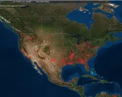
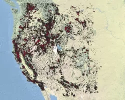
Oregon Wildfires (Summer 2022) Team: Brenna Hatch (Project Lead), Kenya Creer, Jennifer Sobolewski, Nicole Roberts Summary: Wildfire season in the western USA is starting earlier...
![NDMI over a wildland urban interface in central Chile generated from Landsat 8 OLI median-reduced data from March 1, 2018 through February 28, 2022. Orange areas represent vegetated shrublands and forests with low moisture content and green areas representing vegetated agricultural areas with high moisture content. The NDMI was used as a proxy for wildfire fuel moisture in a wildfire risk assessment.](/sites/default/files/styles/lis/public/2022-12/2022Sum_LaRC_ChileWildfires_WebsiteImage_V2.jpg.webp?itok=YJDde00a)
Chile Wildfires (Summer 2022) Team: Chris Matechik (Project Lead), Reuben Alter, Jennifer Ruiz, Stephen Sene Summary: In recent years, Central Chile has experienced wildfires of...
![Median daily evapotranspiration (ET) from September 2021 to May 2022 calculated from ISS ECOSTRESS data. The image covers the agricultural fields adjacent to the Maipo River, Chile and depicts water stress. The color scale ranges from red (low ET) to blue (high ET), with higher ET observed over irrigated agricultural fields. ET is used for estimating crop irrigation requirements. This data will inform irrigation management practices and help alleviate water scarcity within the area. ](/sites/default/files/styles/lis/public/2023-01/2022Sum_ID_IdahoWildfires_WebsiteImage.jpg.webp?itok=MgV2NTHF)
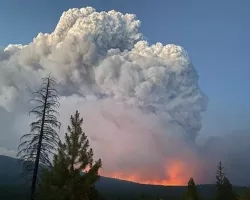
IDAHO WILDFIRES (Summer 2022) Team: Ford Freyberg (Project Lead), Carson Schuetze, Jessica Hiatt, Brenner Burkholder Summary: Escalating severity and frequency of drought and wildfire call...