Displaying 41 - 50 of 94
![2022 Spring CO Boulder County Disasters Website Image](/sites/default/files/styles/lis/public/2022-06/2022Spring_CO_BoulderCountyDisasters_WebsiteImage.png.webp?itok=1X2GgkIw)
Boulder County Disasters (Spring 2022) Team: Sarah Hettema (Project Lead), Jennifer Rogers, Ibuki Sugiura, Erin Twaddell Summary: In recent years, record-breaking wildfire activities in the...
![Annual max biomass calculated from 2021 daily Harmonized LandSat Sentinel-2 (HLS) dataset. Dark purple colors show low biomass while the bright orange show high biomass. Regions with high vegetation and tree canopy cover are shown in orange on the left of the image. High biomass values are of an interest to rangeland managers to help inform their grazing decisions based on which areas of the ranch produce the most biomass/vegetation.](/sites/default/files/styles/lis/public/2023-02/2022Fall_CO_EasternPlainsAgr_WebsiteImage.jpg.webp?itok=StO3rYYa)
Eastern Plains Agriculture (Fall 2022) Team: Jillian Joubert, Sarah Hettema, Deni Ranguelova, TR Ingram, Max Stewart Summary: Adaptive management on cattle ranches requires rangeland managers...
![Median daily evapotranspiration (ET) from September 2021 to May 2022 calculated from ISS ECOSTRESS data. The image covers the agricultural fields adjacent to the Maipo River, Chile and depicts water stress. The color scale ranges from red (low ET) to blue (high ET), with higher ET observed over irrigated agricultural fields. ET is used for estimating crop irrigation requirements. This data will inform irrigation management practices and help alleviate water scarcity within the area. ](/sites/default/files/styles/lis/public/2022-11/2022Sum_PUP_MaipoRiverValleyAg_WebsiteImage.jpg.webp?itok=DiGPgMrj)
Maipo River Valley Agriculture (Summer 2022) Team: Benjamin Goffin (Project Lead), Duncan Srsic, Rishudh, Sarah Carlos Summary: Agriculture is the primary use of water in...
![](/sites/default/files/styles/lis/public/images/develop-legacy/2020/summer/images/2020Sum_CO_FishersPeakEco_WebsiteImage.jpg.webp?itok=43PBiYuq)
Topic
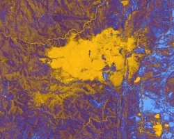
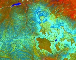
Fisher’s Peak is a 77.5 km2 property southeast of Trinidad, Colorado that is planned to become Colorado’s newest state park. The area has experienced limited...
![Normalized Difference Moisture Index (NDMI) processed 2021 Landsat 8 OLI imagery over land and Sentinel-2 MSI over ocean, ranging from yellow (low) to blue (high), for Hilo, Hawaii. Overlayed with four-day rainfall accumulation cells in blue acquired during Hurricane Lane (Aug 22-25, 2018) from CHIRPS Daily. NDMI monitors water content of leaves and is useful for classifying land cover. Impervious surfaces and areas that have received excessive historical rainfall are susceptible to future flood events.](/sites/default/files/styles/lis/public/2022-03/2021Fall_AZ_HawaiiIslandDisasters_WebsiteImage_1440.png.webp?itok=UF3NMIoI)
Hawai‘i Island Disasters (Fall 2021) Team: Garren Kalter (Project Lead), Rose Eichelmann, Sanketa Kadam, Erin Azuma, and Anna Mikkelsen Summary: As the County of Hawai‘i...
![](/sites/default/files/styles/lis/public/images/develop-legacy/2020/fall/images/2020Fall_MA_CharlesRiverWatershedWater_WebsiteImage.jpg.webp?itok=DHzT_yqT)
Topic
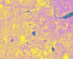
The Charles River watershed intersects 35 municipalities within the Boston Metropolitan Area and has a population of 1.2 million, making it one of the most...
Topic
Principal Investigator: Miguel Villarreal, USGS Western Geographic Science Center (mvillarreal@usgs.gov) Co-Investigator: Brian Ebel, USGS Water Mission Area-Earth System Processes Division (bebel@usgs.gov) Wildfires increase flood and...
![](/sites/default/files/styles/lis/public/images/develop-legacy/2020/fall/images/2020Fall_MSFC_Amazonia_Disasters_Website_Image.jpg.webp?itok=8SzNXrl9)
Topic
Artisanal and small-scale gold mining (ASGM) is responsible for a large fraction of deforestation and disturbance in Amazonia. These activities cause severe impacts on the...
![NDWI-processed imagery from Landsat 8 Operational Land Imager data. This mosaicked image was taken from January to December 2021 of Jekyll Island, Georgia. NDWI contrasts the water features in a satellite image to its surroundings by measuring the moisture content. Low moisture content is shown in white, and high moisture content is shown in blue.](/sites/default/files/styles/lis/public/2023-02/2022Fall_GA_Disasters_WebsiteImage.png.webp?itok=_4Frkxe1)
Georgia Disasters (Fall 2022) Team: Isabella Chittumuri (Project Lead), Nancee Uniyal, Nathan Tesfayi, Shakirah Rogers Summary: In September 2017, Hurricane Irma made landfall in southern...