Update 4/13/21:
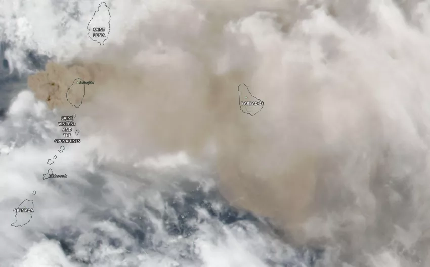
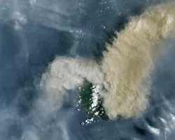
The La Soufrière volcano in Saint Vincent and the Grenadines has seen an increase in eruptive activity, with multiple explosions starting on Friday, April 9, triggering pyroclastic flows - dangerous and fast-moving avalanches of hot ash and gas. The eruption has blanketed the island with ash and debris, contaminating agricultural fields and water supplies. The nation’s National Emergency Management Organization (NEMO) has declared a red alert and evacuated over 16,000 people according to media reports, and UNITAR has activated the International Disasters Charter on behalf of the World Food Programme.
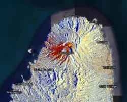
According to the University of the West Indies Seismic Research Center (SRC), an explosive eruption began at La Soufriere at 8.41am the morning of Friday, April 9, sending ash over 40,000 feet into the atmosphere according to NOAA GOES-16 satellite observations. Since then, at least 14 explosive eruptions have been reported from Friday through Monday.
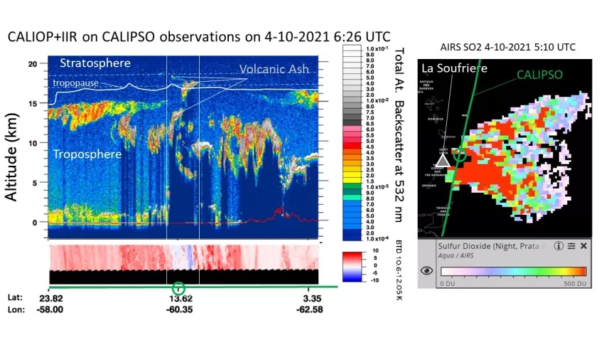
NASA is continuing efforts to monitor and assess the volcanic activity using Earth-observing data in order to provide guidance and situational awareness for decision-making. Researchers and disaster coordinators from NASA’s Earth Science Applied Sciences Disasters program area are working closely with regional stakeholders and volcano research organizations including the SRC, the Institut de Physique du Globe de Paris, France (IPGP), the Montserrat Volcano Observatory (MVO), and the NASA Socioeconomic and Data and Applications Center (SEDAC). The Disasters program area is also in contact with the Pan American Health Organization (PAHO) and USAID Bureau of Humanitarian Assistance. The program is working closely with the NASA Health and Air Quality Applied Sciences Team (HAQAST) to understand the air quality aspects of the eruption and the impacts of falling ash in regions where people have been relocated away from the most dangerous areas close to the volcano. NASA stands ready to aid response and recovery efforts as the volcano continues to impact local communities.

NASA Products for the La Soufrière Eruption
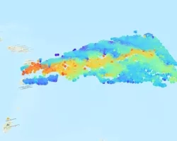
View fullscreen on the NASA Disasters Mapping Portal
UPDATE 1/8/21:
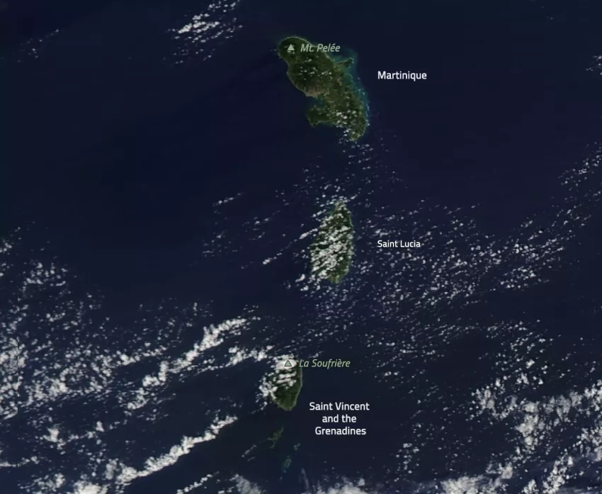
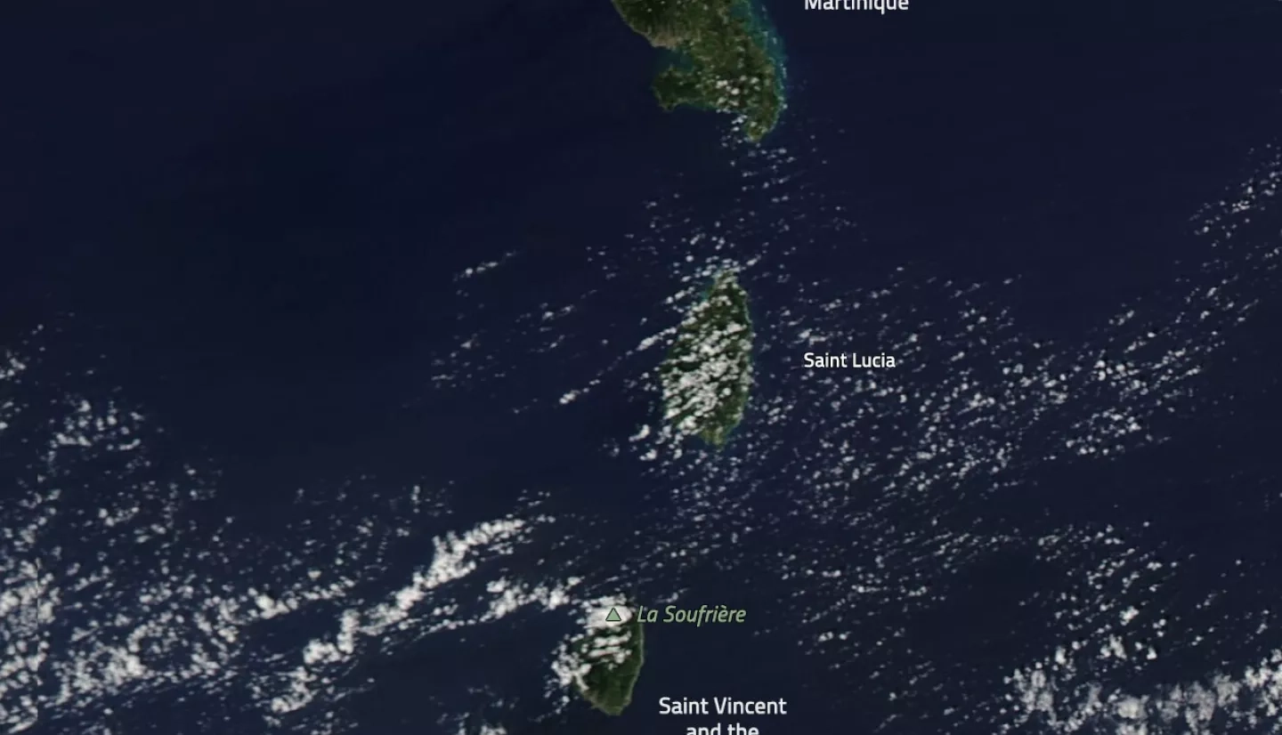
Two volcanoes in the Caribbean have shown signs of increased activity at the end of 2020 – the La Soufrière volcano on Saint Vincent and the Grenadines, and Mount Pelée on Martinique.
According to the Seismic Research Center at the University of the West Indies, there has been no explosive eruption at La Soufrière so far, but magma reaching the surface is forming a growing dome in the crater. The volcano is also releasing gas and steam, which has started affecting vegetation on the flanks of the volcano and within the crater. As of Jan. 21, the current volcano alert level for La Soufrière is orange. Click here for the latest updates on the La Soufrière volcano from the National Emergency Management Organization of Saint Vincent and the Grenadines.
In Martinique, seismologists from the Observatoire volcanologique et sismologique de Martinique (OVSM) of the Institut de Physique du Globe de Paris, France (IPGP) detected a significant increase in seismicity as of April 2019 that further increased in November 2019. Volcanic tremors and long-period earthquakes have also been recorded from seismometers on Mt. Pelée since November 2020. This seismic activity has continued since then, albeit with fluctuations. However, the OVSM IPGP has not recorded any surface activity. As of Dec. 4, 2019, the current volcano alert level for Mount Pelée is yellow. Click here for the latest updates on the Mount Pelée volcano from the IPGP.
When La Soufrière of St. Vincent last erupted in 1979 over 20,000 people were evacuated. An eruption in 1902 killed 1,565 people. Before that, the last major eruption in the region was in 1812.
The NASA Earth Applied Sciences Disasters Program has been activated to aid risk reduction efforts for a potential explosive volcanic eruption, and is closely monitoring the region. The program responded to an initial request for assistance from the U.S. Agency for International Development (USAID) coordinated by the NASA Applied Sciences SERVIR program, and is now working directly with the USGS Volcano Disaster Assistance Program (VDAP) to identify and analyze Earth-observing data that may be helpful in preparing for a potential eruption and mitigating its impacts. The Disasters Program is also working directly with researchers from the Seismic Research Center and the IPGP, and is publishing relevant data products on the NASA Disaster Mapping Portal.
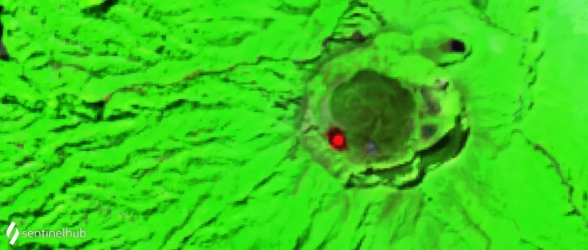
The teams have used short wave infrared data from the European Space Agency (ESA) Copernicus Sentinel-2 satellite to identify a thermal anomaly in the La Soufrière volcano (St Vincent), indicating that magma is close to the surface.
Learn more about how NASA supports risk reduction, response and recovery efforts for volcanoes.
Related Impact