Image

NASA
NASA
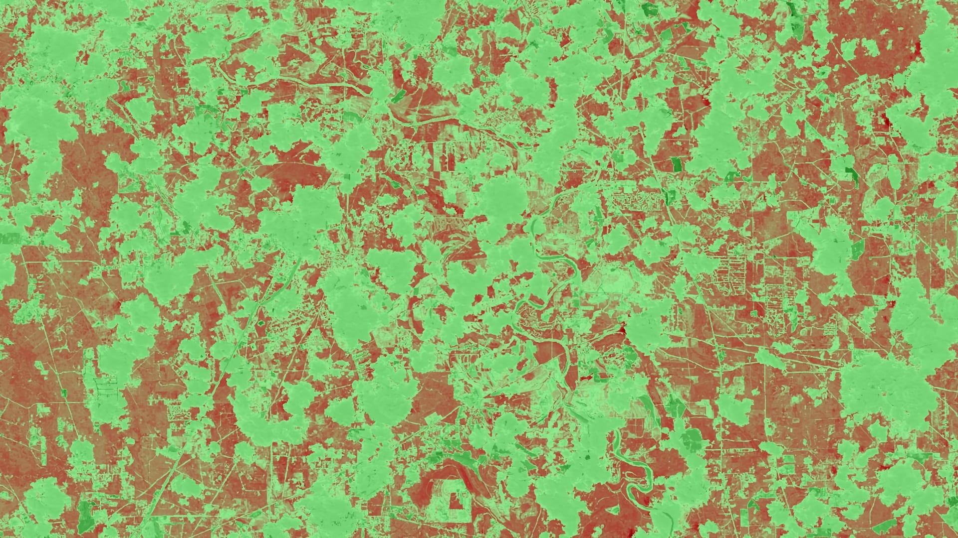
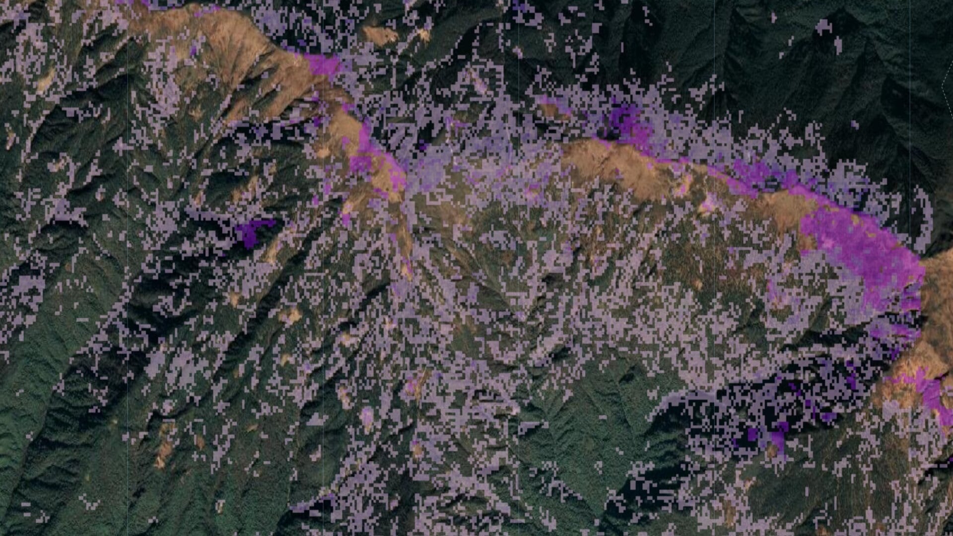
Tasseled cap greenness transformation derived from Landsat 8 imagery over lodgepole pine forest in the Intermountain West study area
Completed Projects
Gia Mancini
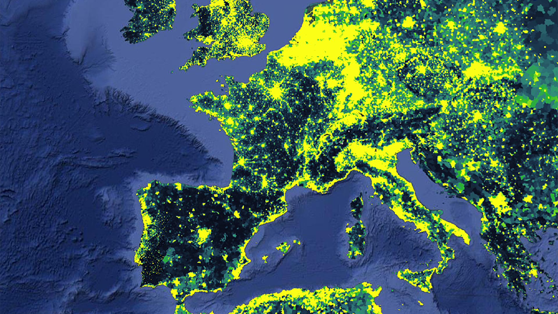
Vector-borne diseases, caused by pathogens and parasites, are transmitted through living organism carriers known as vectors. Mosquitoes are the most common disease vectors and transmit illnesses such as Zika, West Nile, chikungunya, malaria, dengue, and yellow fever. These diseases affect millions of people around the...
Chris Ploetz
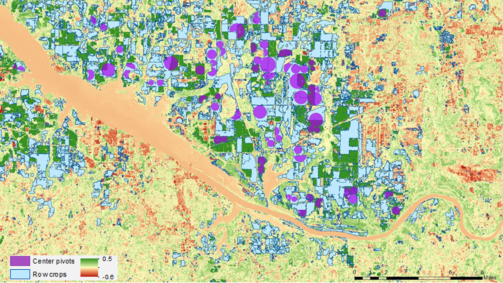
Drought in Alabama has a major impact on agriculture, causing crop yields to fall well below their normal numbers throughout the state. This project researched drought conditions experienced in 2012 and 2016 and the impact the conditions had on corn production. The Alabama Office...
Charlotte Mays
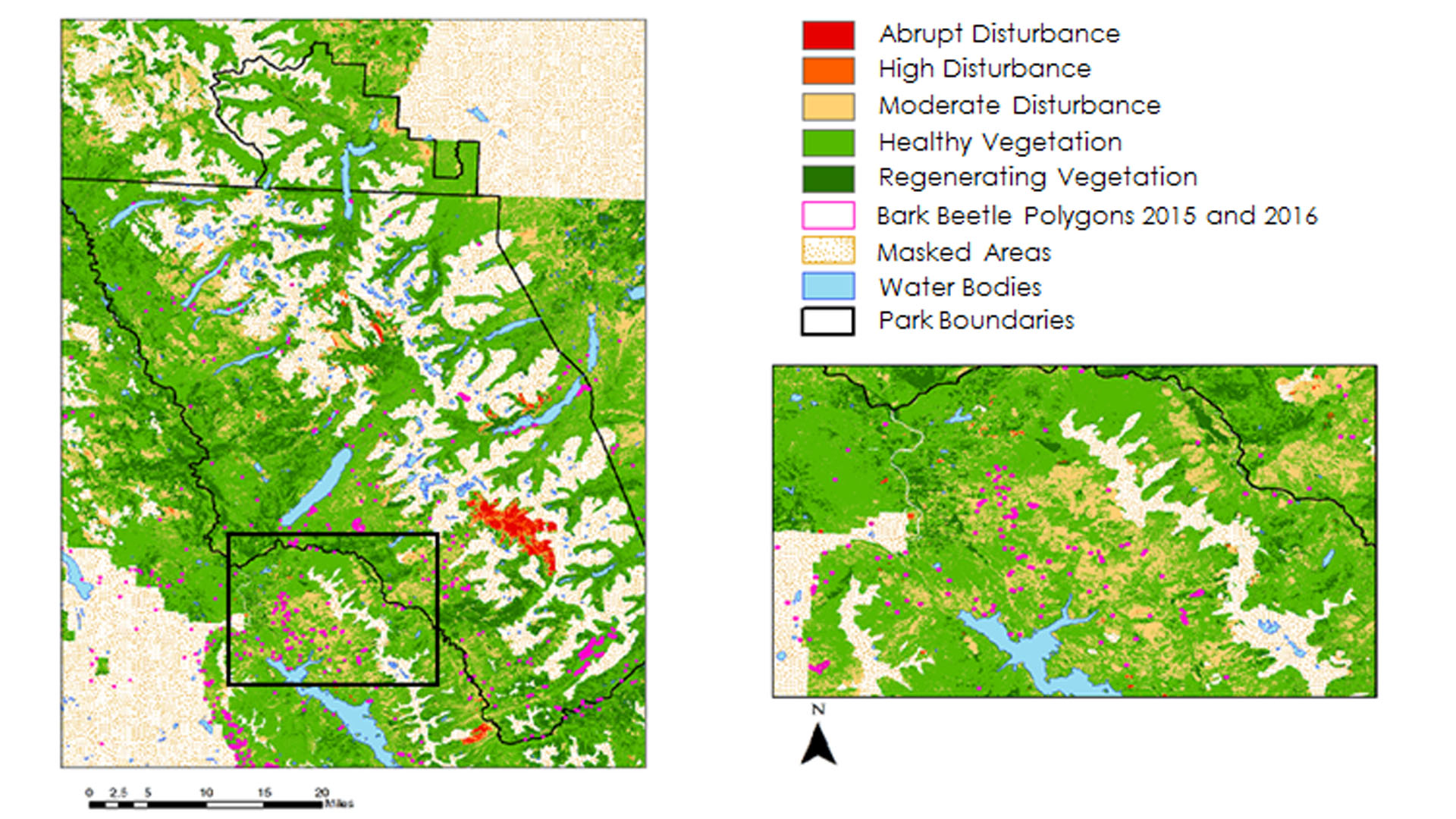
Insects and pathogens cause extensive damage to pine forests in the northwestern United States. Bark beetles in particular cause mortality in pine stands that can impact the timber industry and national parks. Previously, studies have used spectral indices derived from Landsat time series to...
Anna Stamatogiannakis
In 2011, Texas experienced a severe drought that caused substantial economic and environmental losses. The Texas A&M Forest Service (TFS) estimated that 300 million trees succumbed to the severe drought conditions, with urban areas, in particular, losing about 5.6 million...
Tashi Choden
Forest disturbances from bark beetle outbreaks are a major concern in Bhutan, known to cause extensive tree mortality to pine and spruce forests. The NASA DEVELOP team partnered with the Ugyen Wangchuck Institute of Conservation and Environmental Research (UWICER), the...
Megs Seeley
Several major and small-scale hurricanes have swept over the US Virgin Islands (USVI) dating back to 1989. Often originating near the Cabo Verde islands near western Africa, these major hurricanes travel westward towards the USVI, leaving destructive impacts upon landfall. Nearshore marine ecosystems in the...
Lael Wakamatsu
The California grunion is an endemic fish species vital to the California coast, acting as a versatile food source for many species such as seabirds, large mammals, and other fish in the food web. This species, known primarily for the unique way in which they...
Melissa Ferriter
The Woolsey Fire began on November 8, 2018, and lasted for almost two weeks, during which it burned almost 100,000 acres of valuable landscape and habitat, including a vast area of woodland. The persistence of key woodland species provides aesthetic...
Carter Grimm
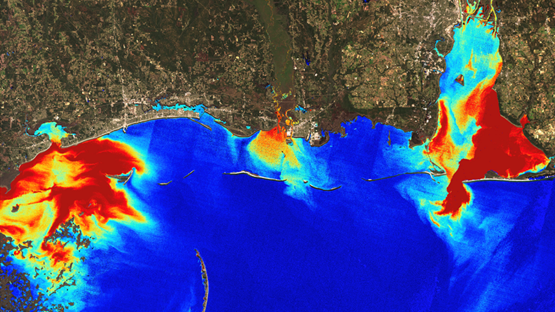
Oysters are vital to the environmental health of the Mississippi Sound and a critical part of Mississippi's economy. Environmental disturbances, such as Hurricane Katrina, major flooding events, and the Bonnet Carré spillway openings, have caused oyster populations to decline and have has negatively affected the...
Terra Edenhart-Pepe

As flooding events in the United States grow in frequency and intensity, the use of technological advancements and applied science is increasingly necessary for effective flood monitoring and warning systems. Governments are exploring new ways of using science and technology to...