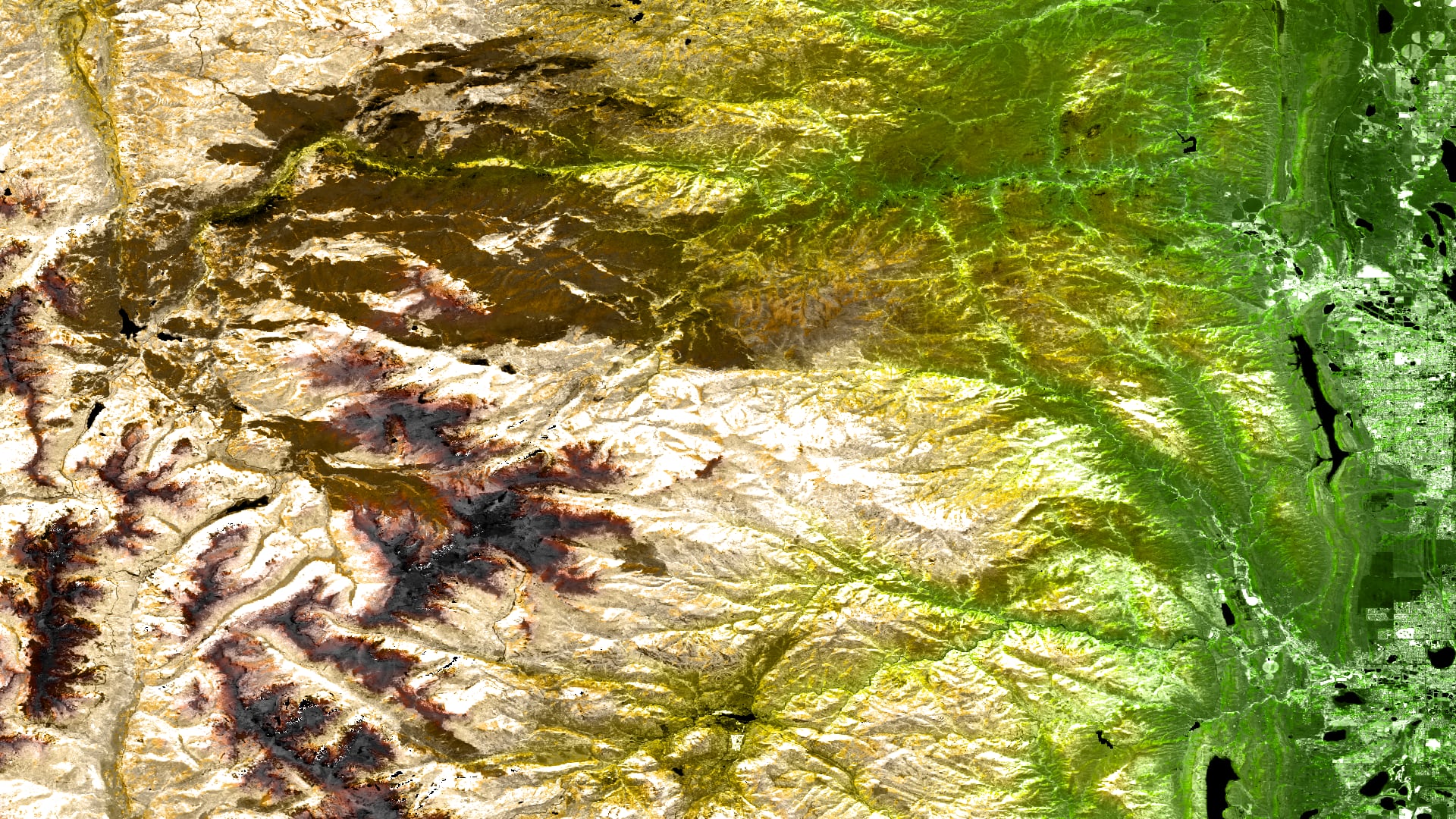
Principal Investigator

Jen Schellman

Imagen
Monitoring and Predicting the Spread of the Roseau Cane Die-offs Connected to the Invasive Mealy Bug (Nipponaclerda biwakoensis) and Other Contributing Factors in the Mississippi River Delta Using NASA Earth Observations

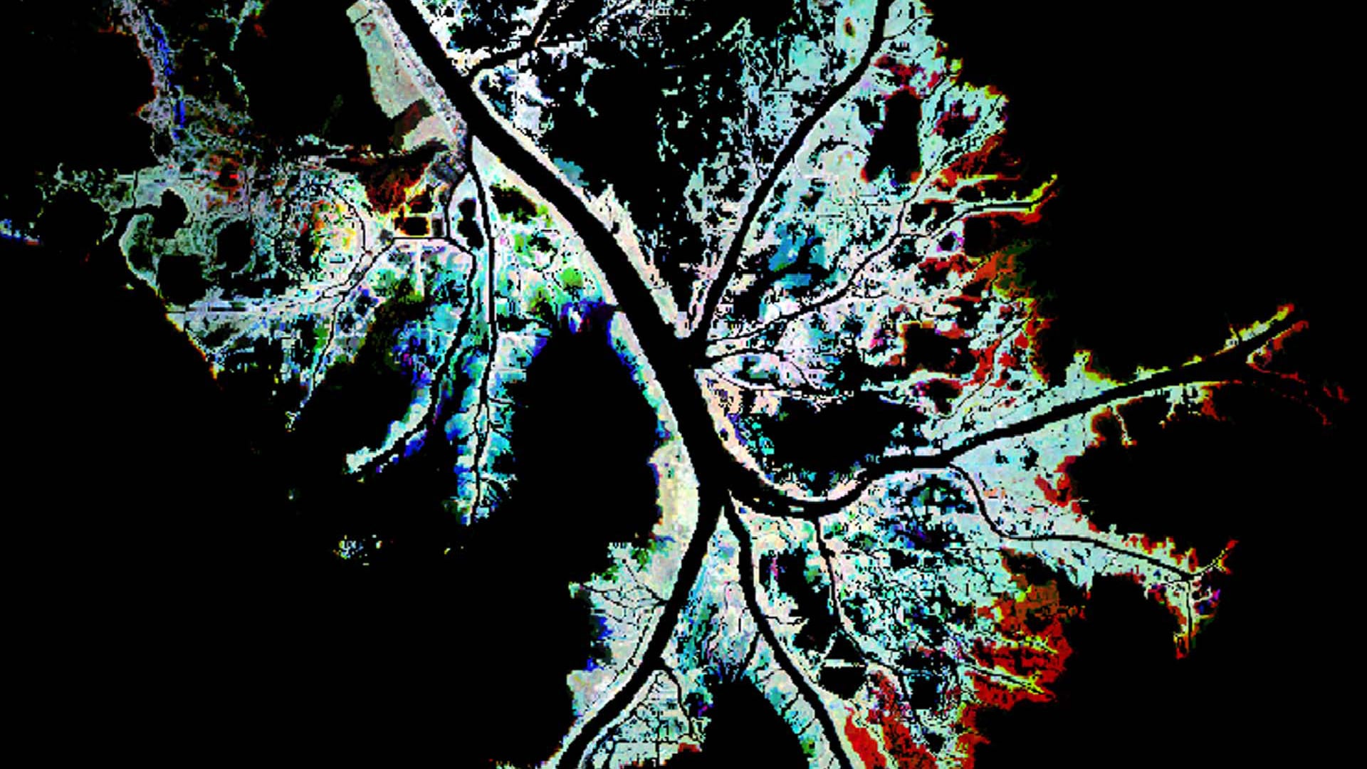
The Roseau cane mealy bug (Nipponaclerda biwakoensis) is an invasive scale insect discovered in the United States during the 2016-2017 die-offs of Roseau cane (Phragmites australis) in the Mississippi River Delta, Plaquemines Parish, LA. Roseau cane stabilize sediment, protect against wave-action and storm surge, and...

Principal Investigator

Ella Griffith

Wildfire smoke has long-lasting impacts on public and environmental health. Currently, agencies that monitor smoke base their decisions on an analysis of how fires burn, the direction the smoke moves from the fire source, and unverified estimates of mixing height. Mixing heights describe...
Principal Investigator

Brigitte Moneymaker

Imagen
Monitoring Bighorn Sheep Habitat by Assessing Vegetation, Topography, and Soil Moisture

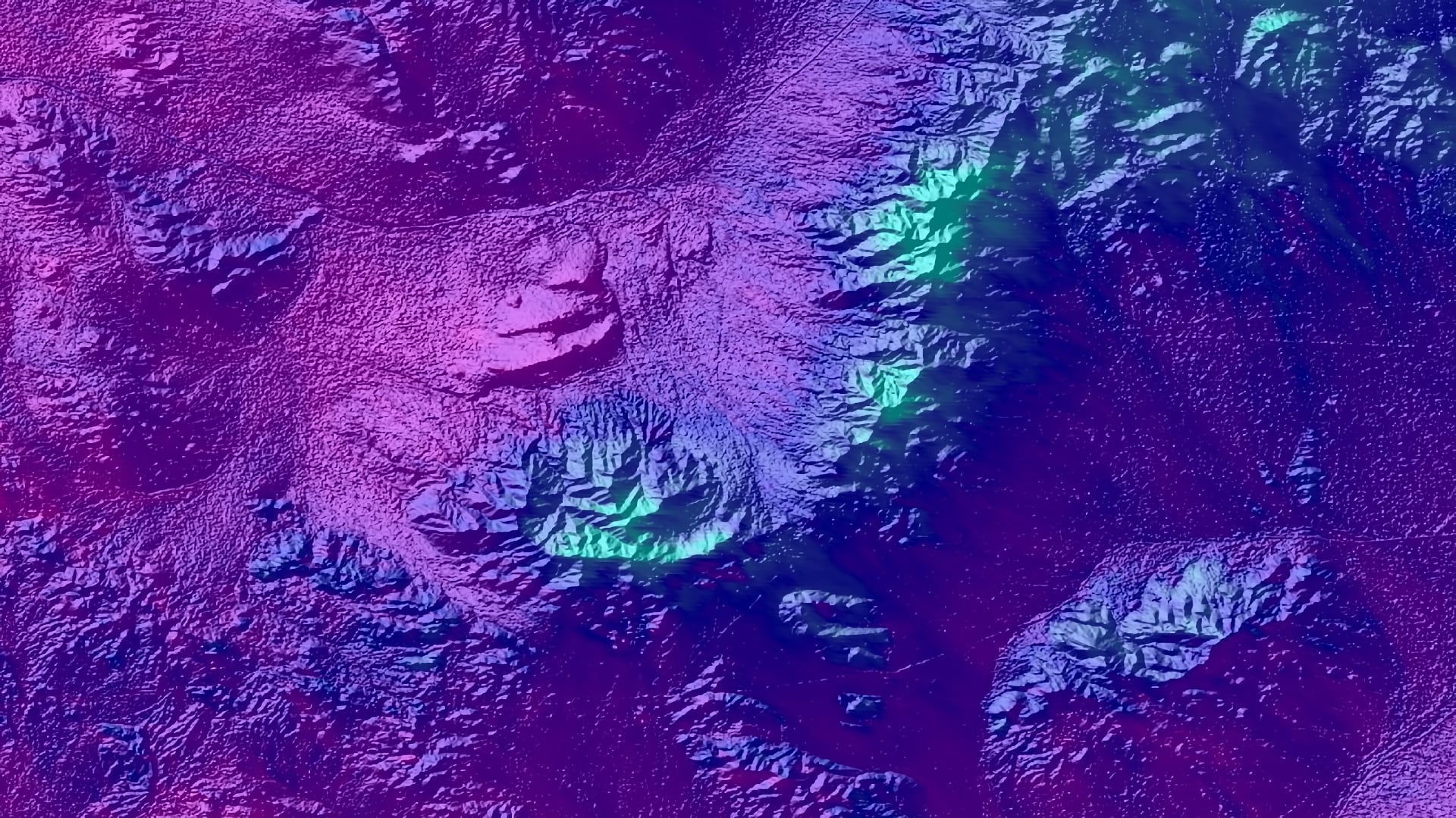
Bighorn sheep are a charismatic desert species that have enormous ecological and cultural significance to the Mojave Desert region in California. After overcoming large population losses in the late 1900s, further habitat degradation and fragmentation has continued to affect the livelihood of remaining bighorn sheep...

Principal Investigator

Eric White

Imagen
Monitoring Exceptional Air Pollution Events in Texas using NASA Earth Observations

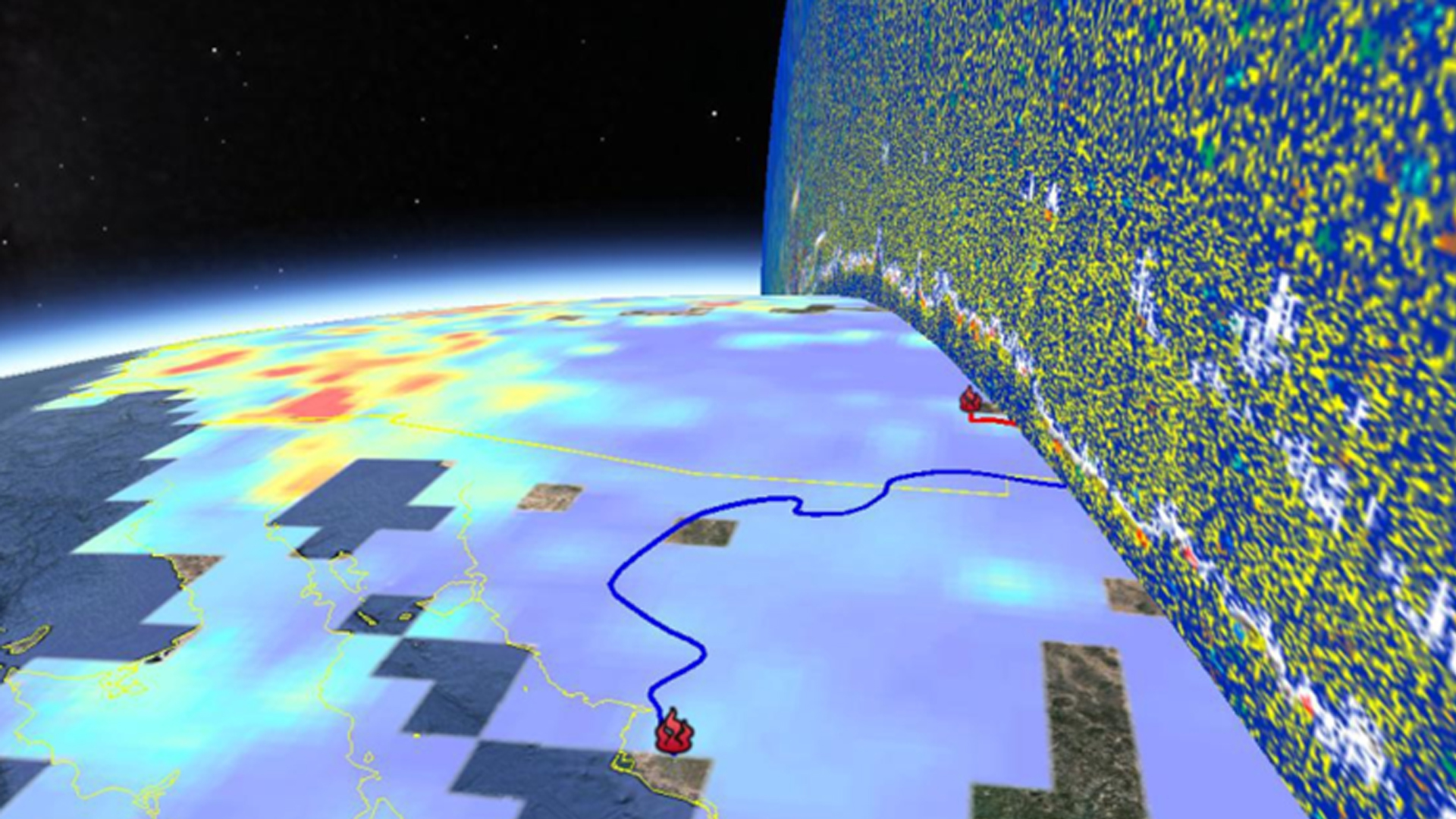
Wildfires in Texas have the potential to impact not only the areas of origin but also the entire state. Smoke plumes from wildfires travel across the state with trajectories that are greatly influenced by meteorological conditions. The plumes transport pollutants, which include those present in...

Principal Investigator

Adelaide Schmidt

Imagen
Resampled imagery of Soil Moisture Active Passive (SMAP) L4 Global 3-hourly 9 km EASE-Grid Surface and Root Zone Soil Moisture Analysis Update, Version 4 in northern Kentucky. Brown regions represent low soil moisture content, while blue-green regions represent higher soil moisture content. SMAP can be used to supplement in-situ soil moisture data from gathered by the Kentucky Mesonet.  Keywords: SMAP, Root Zone Soil Moisture, Kentucky

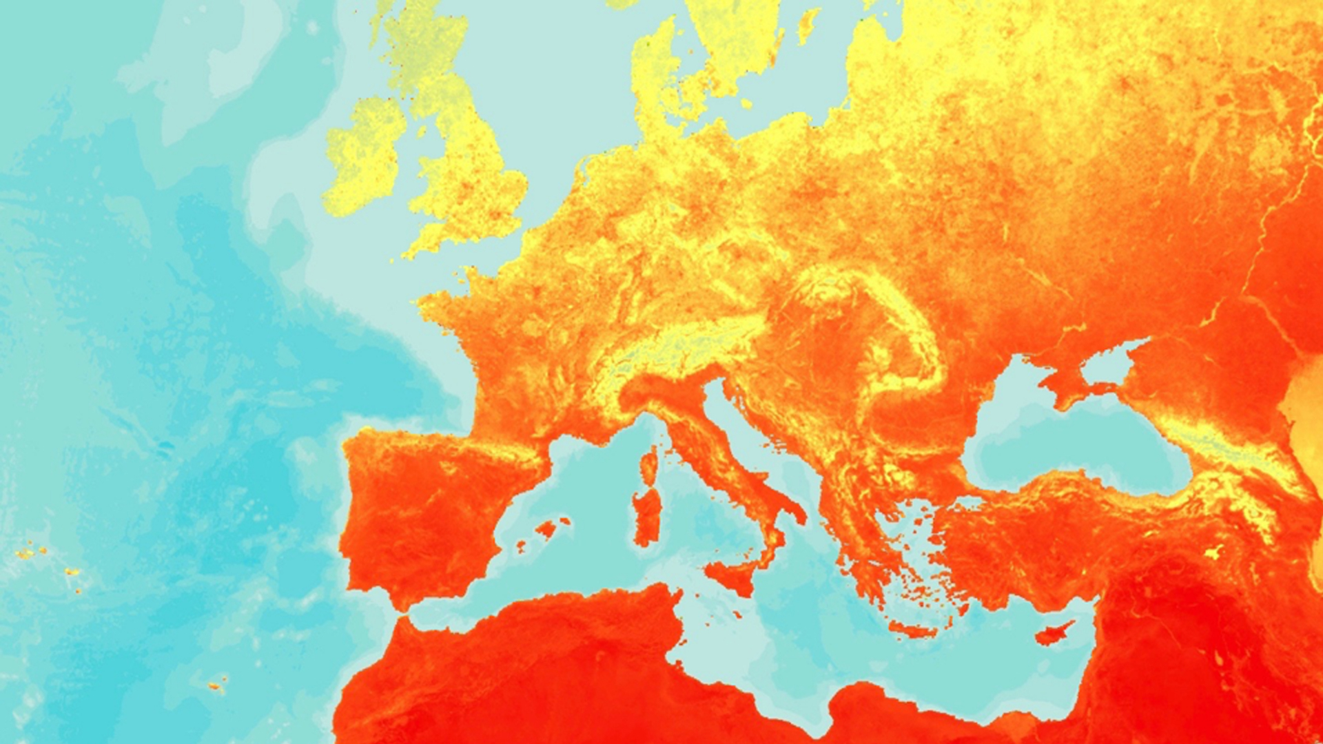
Flash drought conditions emerge in a matter of weeks following persistent weather anomalies, such as high temperatures or large vapor pressure deficits, that drive increased evaporative demand. Vegetation response rapidly depletes soil moisture, threatening surface water supplies, triggering significant crop...

Principal Investigator

Gina Cova

Imagen
Tasseled cap angle transformation applied to 2018 Landsat 8 OLI imagery. Coal mines in the Powder River Basin of Wyoming are displayed. Lighter shades of blue indicate a higher ratio of barren land to vegetation and darker shades indicate a lower ratio of barren land to vegetation. End users can use this transformation as a proxy for identifying how barren, mined lands change over time.

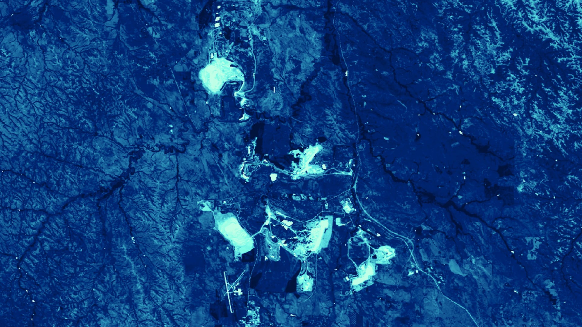
Coal mines in the Powder River Basin of Wyoming account for approximately 41 percent of coal production in the United States, causing significant land disturbances. Without proper reclamation practices, orphan mines create barren, unstable lands unlikely to recover. Where mines have been successfully...

Principal Investigator

Gia Mancini

Imagen
Monitoring Mosquito Abundance and Distribution to Assist Vector-Borne Disease Management in Western Europe

Vector-borne diseases, caused by pathogens and parasites, are transmitted through living organism carriers known as vectors. Mosquitoes, the most common disease vectors, transmit illnesses such as Zika, West Nile, chikungunya, malaria, dengue, and yellow fever, which affect millions of people across the world and kill...

Principal Investigator

Christopher Tsz Hin Choi

Imagen
NDVI processed imagery using 2020 Landsat 8 OLI data blended with 2000 SRTM topography and derived hillshade data. The color scale represents a combination of topography and vegetation health in the Cameron Peak region of northern Colorado. The brown burn scar shows the progression of the Cameron Peak fire and areas with the highest ecological impact. In late 2020, this fire became the largest wildfire in Colorado’s recorded history.  Keywords: Cameron Peak Fire, invasive species, cheatgrass, ecological forecasting, wildfire, Colorado, Christopher Tsz Hin Choi, Alex Posen, Alix Bakke, Monika Rock, Nikole Vannest

Cheatgrass (Bromus tectorum) is a species of concern across the western United States as it has the potential to outcompete native plant species, reduce biodiversity, and diminish nutrient availability for ungulates. Furthermore, because cheatgrass can quickly dominate disturbed...

Principal Investigator

Chet Warren

Imagen
Monitoring Regional Air Quality to Address Air Pollution in National Parks through the Application of NASA Earth Observations

Good air quality is critical for the Intermountain Region of the National Park Service (NPS) to uphold legal mandates, such as the Clean Air Act, to protect park visitor health, the ecological health of the park flora and fauna, and the preservation of the vistas...

Principal Investigator

Rainey Aberle

Imagen
Utilizing 2020 Landsat 8 OLI imagery to monitor stock ponds over the Kaibab National Forest, Arizona: MNDWI and AWEI were calculated for inputs in a K-means clustering algorithm, the green, purple, and blue pixels from left to right represent the MNDWI, AWEI, and the K-means clustering algorithm's ability to automatically detect and delineate water. This product will aid the community in making more timely and low-cost land and livestock management decisions.  Keywords: Stock Ponds, Water-Extent Monitoring, Remote Sensing, Landsat 8 OLI

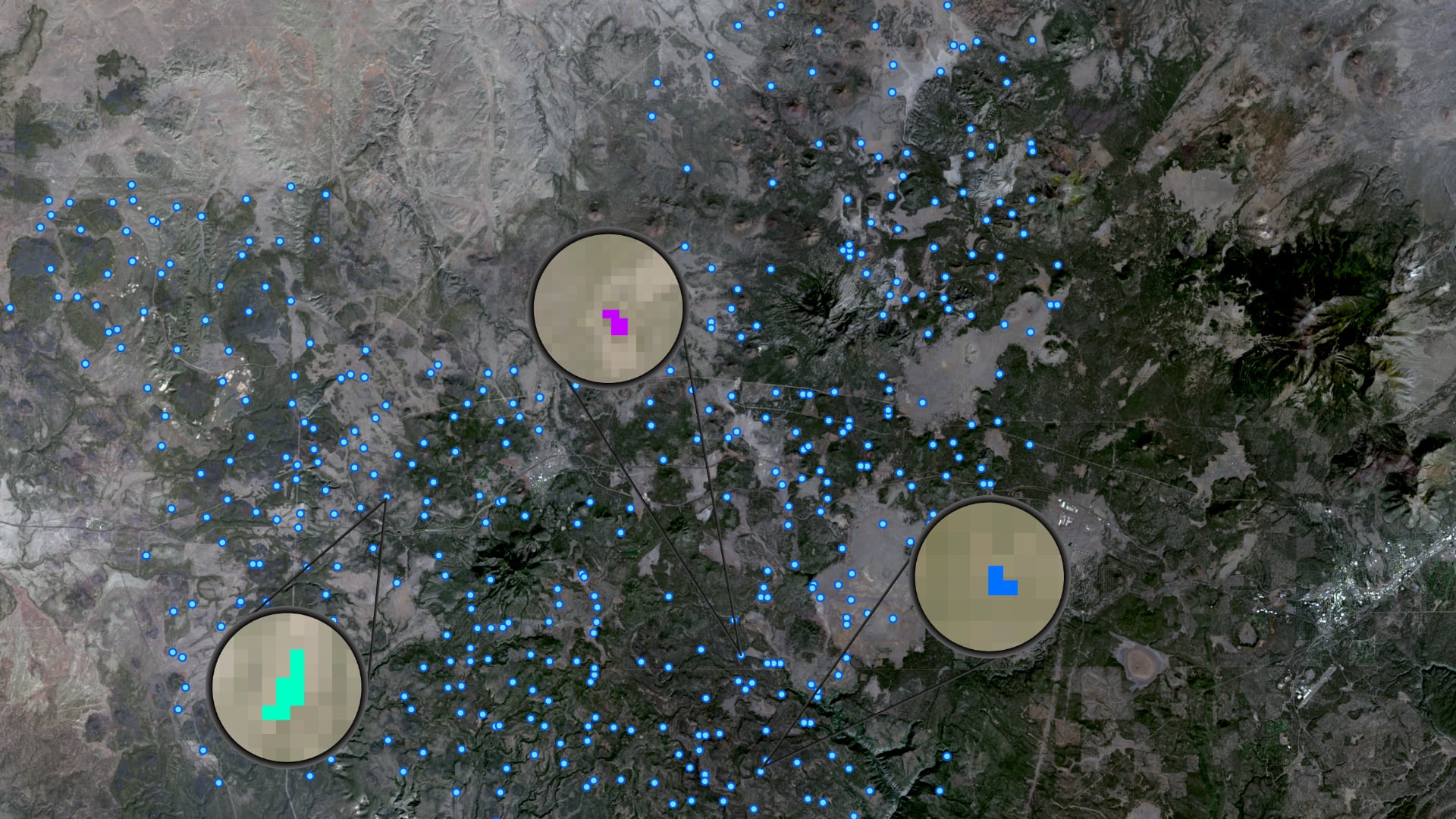
Due to increasingly frequent and severe drought conditions in the southwestern US, land managers and livestock producers need to monitor stock ponds with increasing regularity. The ability to assess stock pond water levels with Earth observing satellite systems would enhance...