Image

NASA
NASA
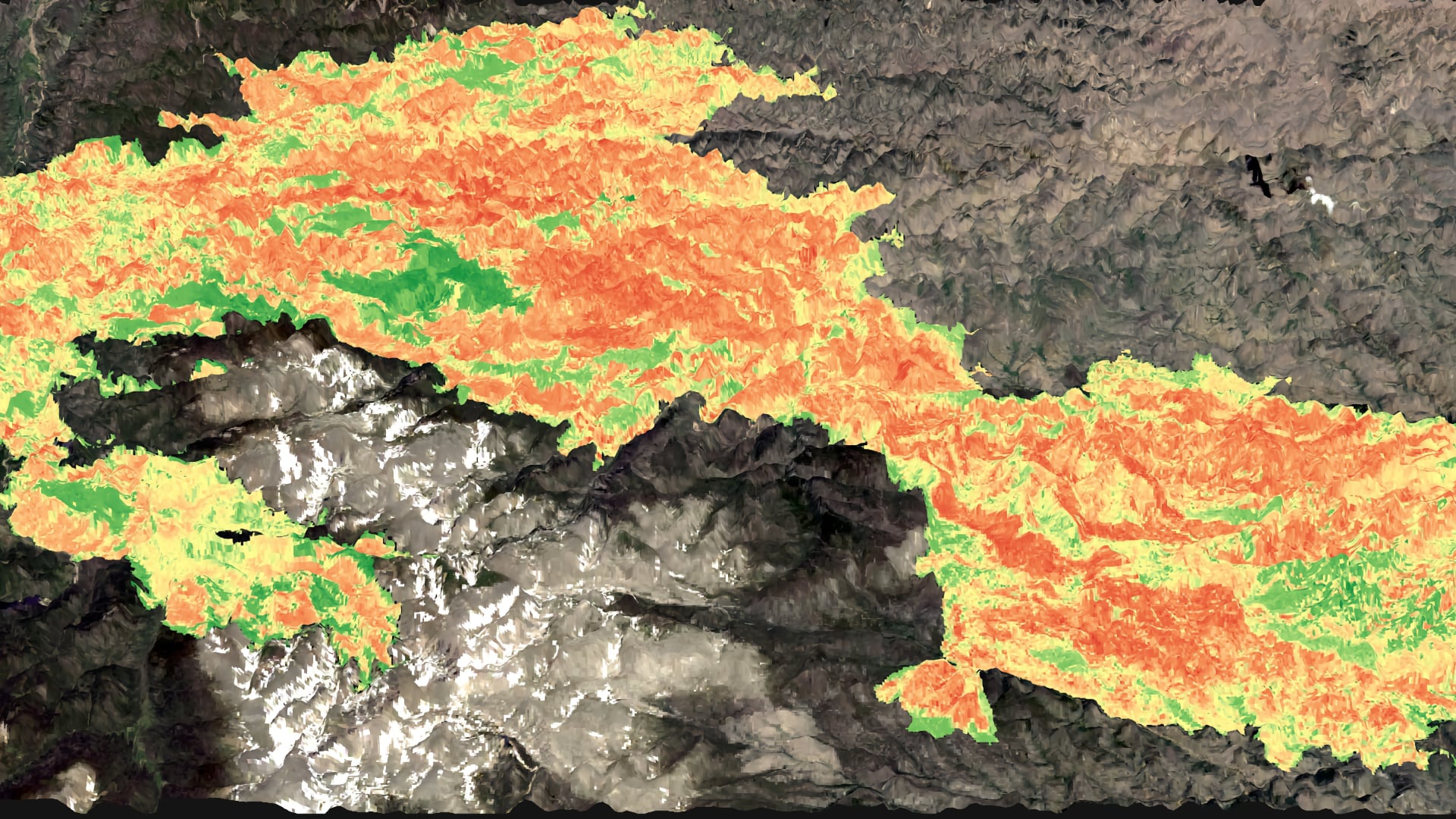
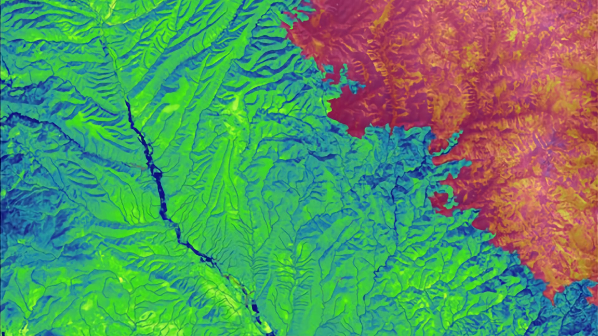
Tasseled cap greenness transformation derived from Landsat 8 imagery over lodgepole pine forest in the Intermountain West study area
Completed Projects
Alana Higgins
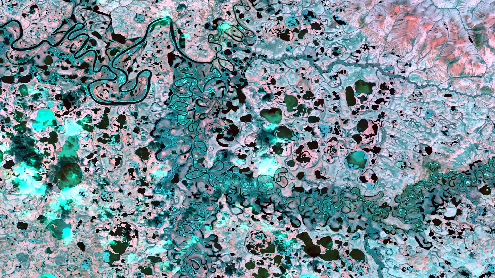
Alaska’s wetlands make up over a third of the state’s land cover and provide numerous ecosystem services, such as water filtration and storage, nutrient retention, and habitat to a diverse range of plant and animal species. Temporal variations in wetland...
Nicholas McVey
Alabama is one of the four most biodiverse states in the United States, and has greatest diversity of aquatic species of any state in the U.S. This biodiversity is at risk as urbanization increases in Alabama. The Land Trust of North Alabama works to preserve...
Meg Fredericks
Cities around the world are adopting adaptation and mitigation strategies for extreme heat events, which are projected to increase in upcoming years. As Richmond, Virginia continues to grow, its residents are more likely to experience more extreme temperatures resulting from the urban heat island effect...
Emily Gotschalk (Project Co-Lead)
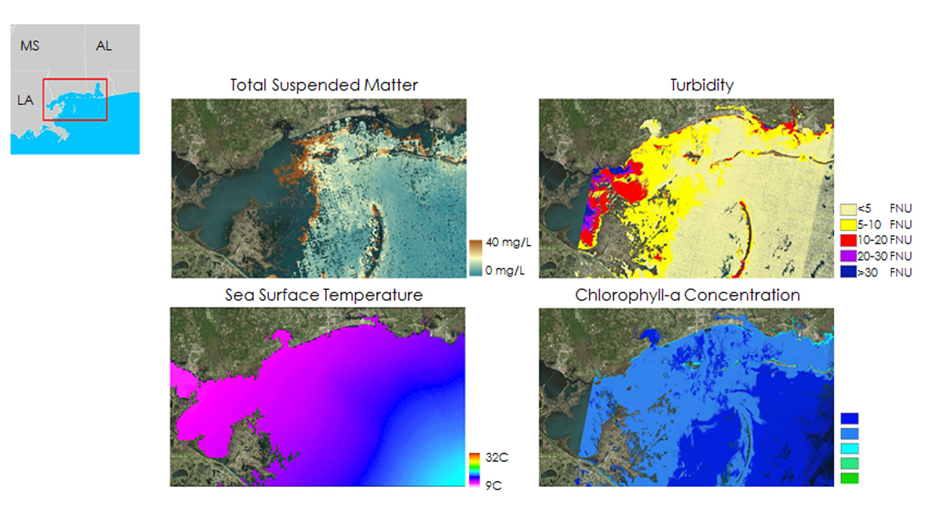
Commercially-harvested oysters are a significant ecological and economic driver in multiple coastal regions throughout the world. In the last decade, the Mississippi Sound has seen a rapid decline in oyster reef production, especially in the years following large ecological disturbances such as Hurricane Katrina...
Joshua Verkerke
Nearly three quarters of Lassen Volcanic National Park (LVNP) is designated as Wilderness under the Wilderness Act of 1964, meaning it is to be managed "to preserve its natural conditions… with the imprint of man's work substantially unnoticeable." This prevents land managers from clearing excess...
Neal Swayze
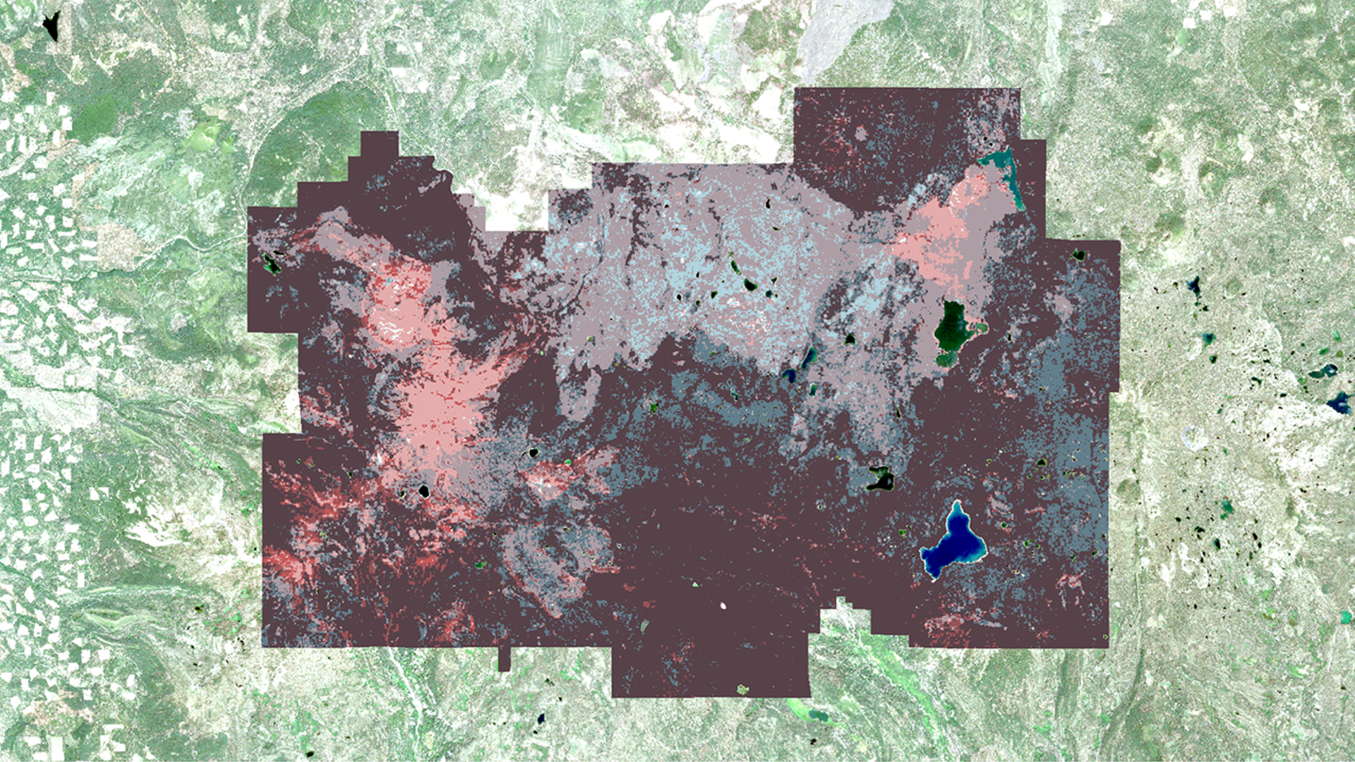
Along the Colorado Front Range, the importance of forest management has gained significant attention due to uncharacteristically intense fires that burned late in 2020. The Cameron Peak Fire, the largest in Colorado’s recorded history, and the CalWood Fire collectively burned an estimated...
Olivia Spencer
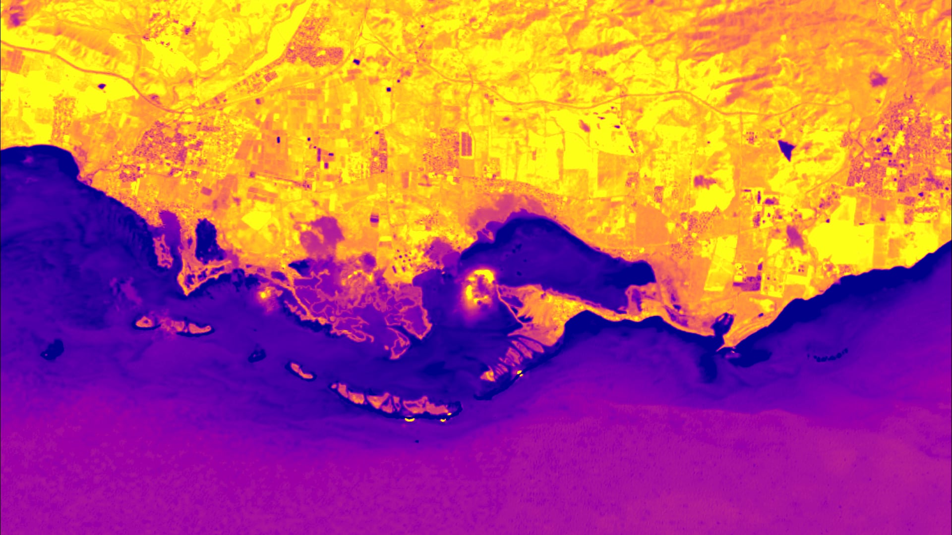
Jobos Bay is located on the southern coast of Puerto Rico, which is known for intense hurricane seasons and increased seasonal storm surge. Scientists at Jobos Bay National Estuarine Research Reserve (JBNERR) are concerned that sea level rise will exacerbate...
Anna Ballasiotes
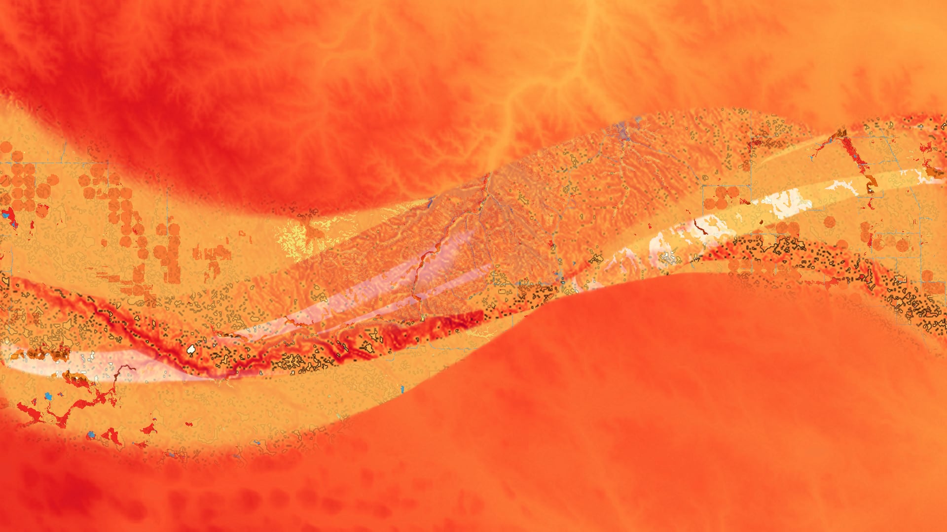
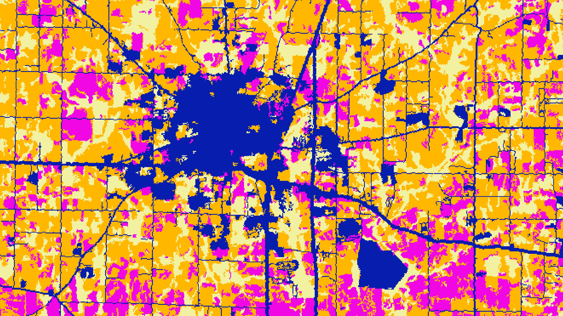
In 2019, the Great Plains experienced unprecedented catastrophic flooding. Large flood events are predicted to increase in frequency and severity, posing risks to communities in this region, particularly Tribal Nations. We used Sentinel-1 C-band Synthetic Aperture Radar (C-SAR), imagery from...
Alia Giolitti
Wildfires have the potential to cause devastating and long-lasting impacts on ecological systems. In the Gila National Forest (Gila NF), wildfire events have occurred with increasing frequency and severity over recent years. These disturbances, such as the historic Whitewater Baldy...
Terra Edenhart-Pepe
The largest fire in New Mexico’s recorded history, the Whitewater-Baldy Complex Fire, occurred in 2012 in the Gila National Forest (Gila NF). Then, in 2013, the Silver Fire broke historic records for destruction of private property. These disturbances have...