Displaying 161 - 170 of 305
![NDVI over Mato Grosso, Brazil processed from March 2021 Landsat-8 OLI data. Calculated NDVI values correspond with colors shown to indicate plant health. High NDVI values (green to blue) indicate dense vegetation found in tropical and temperate forests or crops at their peak growth. Low values (yellow to red) depict barren land, water, and moisture-stressed vegetation. These data can support timely and efficient agricultural responses to ensure productive yields and food security.](/sites/default/files/styles/lis/public/2022-12/2022Sum_NC_MatoGrosso_WebsiteImage_FD.png.webp?itok=JJA3kKJi)
Mato Grosso Agriculture (Summer 2022) Team: Max Rock (Project Lead), Elijah Dalton, Aidan Harvey, Kate Reynolds Summary: Ranked as the fourth largest food producer in...
![](/sites/default/files/styles/lis/public/images/develop-legacy/2019/summer/images/2019Sum_MSFC_CentralAmericaTI_WebsiteImage.jpg.webp?itok=DWQOzdqL)
Topic
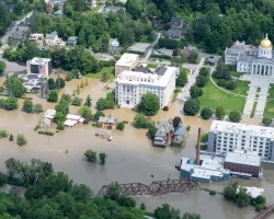
Central America is one of the world’s most vulnerable regions to natural disasters, including landslides and precipitation-driven flooding. In an effort to support disaster management...
![NDWI-processed composite image from Landsat 8 OLI data of the Lower Illinois River Valley and surrounding landscapes from summer 2021. Shades of pale yellow indicate dry vegetation and dark teal represents open water, while brighter turquois values depict wet vegetation. Areas of high NDWI values are demonstrative of high presence of wet vegetation and are of interest to the Great Rivers Land Trust in identifying areas of interest for wetland conservation.](/sites/default/files/styles/lis/public/2022-12/2022Sum_JPL_LowerIllinoisEco_WebsiteImage.png.webp?itok=eCvz2h8C)
Lower Illinois River Valley Ecological Forecasting (Summer 2022) Team: Vanessa Machuca (Project Lead), Dana Myers, Hannah Rigdon, Christiana Saldana Summary: The Lower Illinois River Valley...
![2022 Spring MSFC Okefenokee Water Resources Website Image](/sites/default/files/styles/lis/public/2022-06/2022Spring_MSFC_OkefenokeeWaterResources_WebsiteImage_v2.png.webp?itok=aAUGYAb3)
Okefenokee Water Resources (Spring 2022) Team: Brianne Kendall (Project Lead), Kyle Steen, Hailey Schmidt, Laramie Plott Summary: The Okefenokee Swamp is a vital ecosystem known...
Topic
Description: This project provides a range of surface water products related to lakes, reservoirs, and wetlands in a near real time framework. It also offers...
Topic
Description: This project provides a range of surface water products related to lakes, reservoirs, and wetlands in a near real time framework. It also offers...
![](/sites/default/files/styles/lis/public/images/develop-legacy/2020/summer/images/2020Sum_CO_RockyMtnDisasters_WebsiteImage.jpg.webp?itok=KfhOwFZe)
Topic
Forest composition and structure in the Colorado Front Range has been altered by changing wildfire regimes. In particular, increased moderate- and high-severity fire significantly reduces...
Topic
This proposal aims to expand a lake and reservoir monitoring program. This program is on-line, operational, with an existing decision support system (DSS) in place...
![](/sites/default/files/styles/lis/public/Vermont-flooding-DOD.jpeg.webp?itok=HIf3Cc1H)