Displaying 51 - 60 of 97
Topic
Cali Water Resources (2024 Spring) Team: Tallis Monteiro (Project Lead), Gabi Davidson-Gomez, Nathan Tesfayi, Raquel Trejo Summary: Recent research has documented the global decline of...
Topic
The gopher frog (Lithobates capito) is an endangered species facing extinction within the next century due to loss and alteration of its habitat. With limited...
Topic
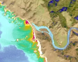
Estuaries are vital ecosystems that serve important ecological functions. The Marine Life Protection Act aims to protect these ecosystems by establishing a network of marine...
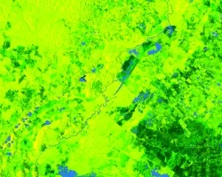
Maya Forest Water Resources II (Fall 2021) Team: Stephanie Jiménez (Project Lead), Karen Alvarez, Rene Castillo, Daniel Nohren, and Stephanie Lawlor Summary: To monitor seasonal...
Topic
Fisher’s Peak is a 77.5 km2 property southeast of Trinidad, Colorado that is planned to become Colorado’s newest state park. The area has experienced limited...

Hawai‘i Island Disasters (Fall 2021) Team: Garren Kalter (Project Lead), Rose Eichelmann, Sanketa Kadam, Erin Azuma, and Anna Mikkelsen Summary: As the County of Hawai‘i...
Topic
The Charles River watershed intersects 35 municipalities within the Boston Metropolitan Area and has a population of 1.2 million, making it one of the most...
Topic
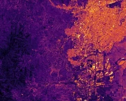
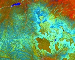
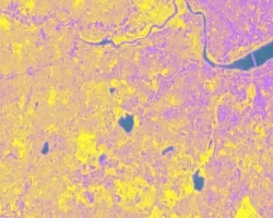
Principal Investigator: Miguel Villarreal, USGS Western Geographic Science Center (mvillarreal@usgs.gov) Co-Investigator: Brian Ebel, USGS Water Mission Area-Earth System Processes Division (bebel@usgs.gov) Wildfires increase flood and...

Topic
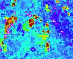
Artisanal and small-scale gold mining (ASGM) is responsible for a large fraction of deforestation and disturbance in Amazonia. These activities cause severe impacts on the...

Georgia Disasters (Fall 2022) Team: Isabella Chittumuri (Project Lead), Nancee Uniyal, Nathan Tesfayi, Shakirah Rogers Summary: In September 2017, Hurricane Irma made landfall in southern...