Displaying 141 - 150 of 305
![An NDWI waterbody mask derived from Landsat-8 OLI cloud-masked imagery from March-May 2019-2021 is shown in blue at 10-meter resolution over Mexico, Belize, and Guatemala. The ALOS-PALSAR-2 fine-beam L-band false color composite includes Refined Lee speckle filtered HV, HH, HH/HV bands. Darker and brighter green hues represent to low and high backscatter, respectively. Differentiating between open water, like the Hondo River, from vegetated inundation is important when distinguishing inundation by land cove](/sites/default/files/styles/lis/public/2022-03/2021Fall_JPL_MayaForestWaterResourcesII_WebsiteImage.png.webp?itok=WSwTB7q7)
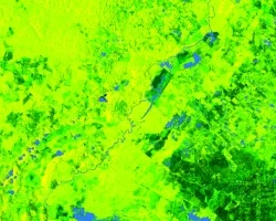
Maya Forest Water Resources II (Fall 2021) Team: Stephanie Jiménez (Project Lead), Karen Alvarez, Rene Castillo, Daniel Nohren, and Stephanie Lawlor Summary: To monitor seasonal...
![](/sites/default/files/styles/lis/public/images/develop-legacy/2021/summer/images/2021Sum_ID_SouthwestWater_WebsiteImage.jpg.webp?itok=AgP7hBPB)
Topic
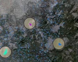
Due to increasingly frequent and severe drought conditions in the southwestern US, land managers and livestock producers need to monitor stock ponds with increasing regularity...
Topic
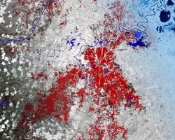
Principal Investigator: Miguel Villarreal, USGS Western Geographic Science Center (mvillarreal@usgs.gov) Co-Investigator: Brian Ebel, USGS Water Mission Area-Earth System Processes Division (bebel@usgs.gov) Wildfires increase flood and...
![Normalized Difference Moisture Index (NDMI) processed 2021 Landsat 8 OLI imagery over land and Sentinel-2 MSI over ocean, ranging from yellow (low) to blue (high), for Hilo, Hawaii. Overlayed with four-day rainfall accumulation cells in blue acquired during Hurricane Lane (Aug 22-25, 2018) from CHIRPS Daily. NDMI monitors water content of leaves and is useful for classifying land cover. Impervious surfaces and areas that have received excessive historical rainfall are susceptible to future flood events.](/sites/default/files/styles/lis/public/2022-03/2021Fall_AZ_HawaiiIslandDisasters_WebsiteImage_1440.png.webp?itok=UF3NMIoI)
Hawai‘i Island Disasters (Fall 2021) Team: Garren Kalter (Project Lead), Rose Eichelmann, Sanketa Kadam, Erin Azuma, and Anna Mikkelsen Summary: As the County of Hawai‘i...
![NDWI-processed imagery from Landsat 8 Operational Land Imager data. This mosaicked image was taken from January to December 2021 of Jekyll Island, Georgia. NDWI contrasts the water features in a satellite image to its surroundings by measuring the moisture content. Low moisture content is shown in white, and high moisture content is shown in blue.](/sites/default/files/styles/lis/public/2023-02/2022Fall_GA_Disasters_WebsiteImage.png.webp?itok=_4Frkxe1)
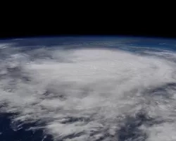
Georgia Disasters (Fall 2022) Team: Isabella Chittumuri (Project Lead), Nancee Uniyal, Nathan Tesfayi, Shakirah Rogers Summary: In September 2017, Hurricane Irma made landfall in southern...
![2022 Spring PUP Mexico Disasters Website Image](/sites/default/files/styles/lis/public/2022-06/2022Spring_PUP_MexicoDisasters_WebsiteImage_v2.png.webp?itok=3ZfxI279)
Mexico Disasters (Spring 2022) Team: Philip Casey (Project Lead), John Willis, Sean Nelsen, Zachary Silberman Summary: In this project, NASA DEVELOP partnered with Mexico’s National...
![](/sites/default/files/styles/lis/public/images/develop-legacy/2021/spring/images/2021Spring_JPL_CCWR_WebsiteImage_V3.jpg.webp?itok=YZI9AtzT)
Topic
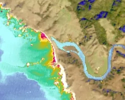
Estuaries are vital ecosystems that serve important ecological functions. The Marine Life Protection Act aims to protect these ecosystems by establishing a network of marine...
![Hurricane Isaias traveling northwest between Cuba and the Bahamas on Friday, July 31, 2020, as seen from the International Space Station. Credits: NASA/Astronaut Col. Doug Hurley](/sites/default/files/styles/lis/public/2020-08/isaias_astronaut.jpg.webp?itok=6vi0Xof4)
![](/sites/default/files/styles/lis/public/images/develop-legacy/2019/summer/images/2019Sum_AL_MobileUrban_WebsiteImage.jpg.webp?itok=581tgURE)
Topic
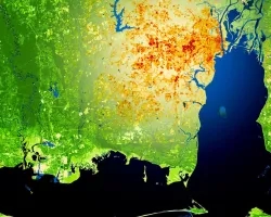
This project utilized satellite Earth observations to assess locations in Mobile County, Alabama, that are vulnerable to the urban heat island effect (UHI) and flood...