In honor of Women’s History Month, the Applied Sciences Program is highlighting six outstanding women and their groundbreaking achievements that help advance life here on Earth.
The six scientists are listed below alphabetically by the name of their program area.
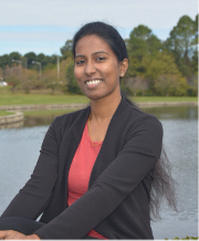
Managing climate risks and monitoring land use – there’s an app for that – thanks to software developer, Githika Tondapu. Tondapu works with the SERVIR initiative under the Capacity Building program area to combine her computer science skills with information provided by Earth-observing satellites and geospatial technologies. She and her team develop applications such as the Air Quality Explorer tool and the Regional Hydrologic Extremes Assessment System (RHEAS) Viewer which help both scientists and end users in Thailand and Africa. Learn more about Tondapu at the story, Bringing Earth Data to Life, One App at a Time: Githika Tondapu.
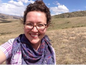
Disasters don’t scare Lori Schultz. As a research physical scientist and Disasters program area center coordinator at NASA’s Marshall Space Flight Center, Schultz teaches end users how to interpret Earth data to help respond to NASA’s most critical disaster questions. Schultz also serves on the floods research team where she uses remote sensing to create flood products that provide support for flood events around the world. She always knew she’d end up in science but the path she took to get to this point in her career is one complex puzzle. Learn more about Schultz at the story, Piecing Together Earth Data with Lori Schultz.

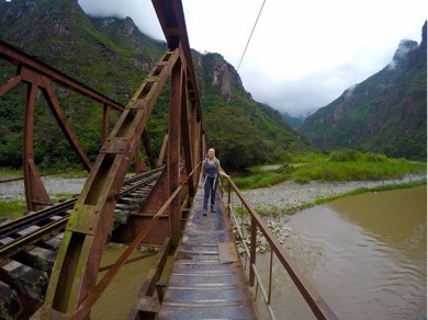
Ginger Allington studies how cashmere goat and sheep grazing affect perennial plants in the Mongolia Plateau. In conjunction with the Ecological Forecasting program area, Allington, an assistant professor of Geography at George Washington University, combines data she collects on the ground with data from the joint NASA-U.S. Geological Survey Landsat series of satellites to understand drivers of degradation and changing rangeland conditions. Allington uses this data to inform regional stakeholders and policymakers of potential steps for recovery. Learn more about Allington at the story, Destination: Mongolia – Understanding the Plateau Rangeland Ecosystem.
Satellite data and machine learning algorithms give Hannah Kerner an eye in the sky to help her analyze crops on the ground. Kerner is an assistant research professor at the University of Maryland and is the machine learning lead and U.S. domestic co-lead for NASA Harvest. With food insecurity risks expected to worsen as climate change continues, Kerner works in conjunction with the Agriculture and Food Security program area to help government decision-makers and farmers address food security and supply, humanitarian aid needs, and imports and exports. Learn more about Kerner at the story, Cracking the Code for Healthy Crops with Hannah Kerner.
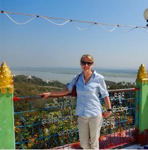
Most people shoo away mosquitos but Tatiana Loboda travels from Maryland to Myanmar to study them. Alongside her team, and supported by the Health and Air Quality program area, Loboda is developing the Myanmar Malaria Early Warning System (MMEWS) to forecast malaria hotspots with data derived from the Landsat and Sentinel-2, ground information, and her five senses. Learn more about Loboda at the story, Gathering On-the-Ground Data with Tatiana Loboda.
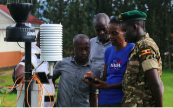
Helping farmers manage their fields and communities increase food security is all part of a day’s work for Catherine Nakalembe. Using NASA satellite data to improve crop monitoring programs, Nakalembe, an assistant research professor at the University of Maryland and principal investigator for SERVIR, works with the Water Resource program area and NASA Harvest to better monitor future food supply and manage responses to natural events. Learn more about Nakalembe at the story, Mapping the Future of Food Security: Catherine Nakalembe.
NASA Disasters also highlighted the contribution of some of the women within their program area. More information is available at that story, Women at the Helm of Disasters Science.
