Principal Investigator

Molly Azami

Imagen
Greenest pixel composite of Normalized Difference Vegetation Index (NDVI)-processed image using 2019 data from Landsat 8 Operational Land Imager  blended with a true color band combination (3, 2, 1) of the Western coast of Costa Rica in the Osa region. The areas of highest vegetation are represented in green, areas of lowest vegetation are represented in red, and water is represented in blue. The land cover characteristics shown in an NDVI image improve land cover classification accuracy.  Keywords: NDVI, Landsat, land cover

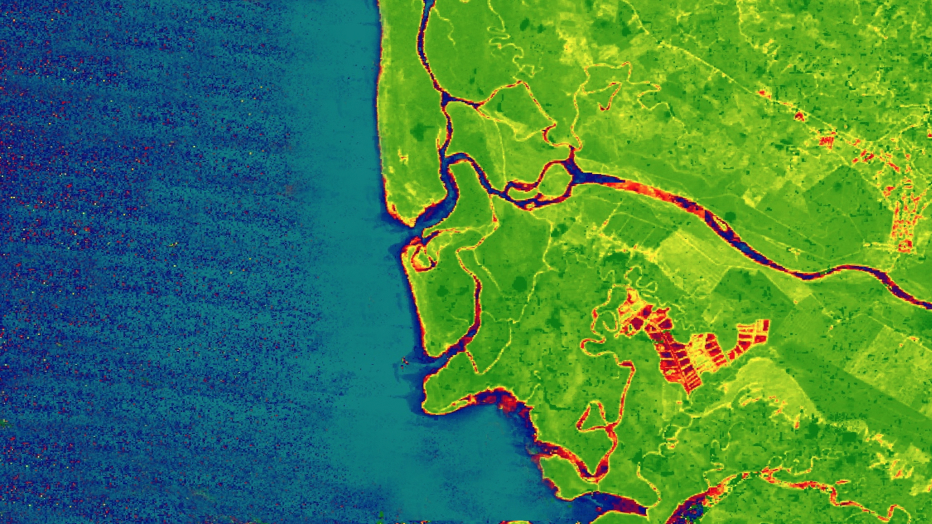
La Amistad International Park connects southern Costa Rica and northern Panama as part of the Mesoamerican Biological Corridor. Despite the existence of conservation programs within this region, human-induced and natural ecological disturbances threaten native species and alter forest ecosystems. To...

Principal Investigator

Hikari Murayama

Imagen
From left to right: 2018 through 2019 Normalized Difference Vegetation Index (NDVI), 2018 through 2019 Enhanced Vegetation Index (EVI), 1987 through 2019 EVI change, and 2018 land use/land cover classification derived from Landsat 5 TM and Landsat 8 OLI data. Dark green, purple, magenta, and green indicate areas of high or increased vegetation. These parameters helped assess habitat connectivity for a jaguar corridor in the southern part of Puntarenas province in Costa Rica.

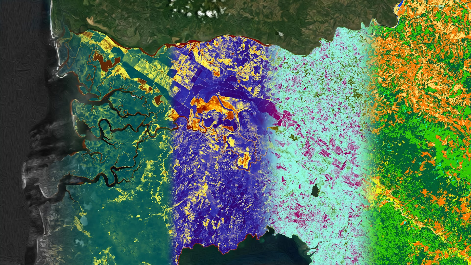
Costa Rica contains many diverse environments, including La Amistad International Peace Park in the Talamanca Mountains and Corcovado National Park on the Osa Peninsula. Jaguars (Panthera onca) can be found throughout these two parks, but urbanization and agricultural development have...

Principal Investigator

Chloe Schneider

Imagen
August 2019 Composite Moisture Index calculated from SMAP, MODIS NDSI, SNODAS SWE, and SNODAS snow depth data overlayed on mean MODIS NDSI data for December 2019 to February 2020 for the Missouri River Basin at a HUC 2 Region 6 scale. Purple CMI values correspond to wetter areas whereas yellow areas correspond to drier areas. Lighter shades of blue for the NDSI data represent more snow cover for that area.   Keywords: CMI, MODIS NDSI, SNODAS SWE, SNODAS snow depth, SMAP, Missouri River Basin

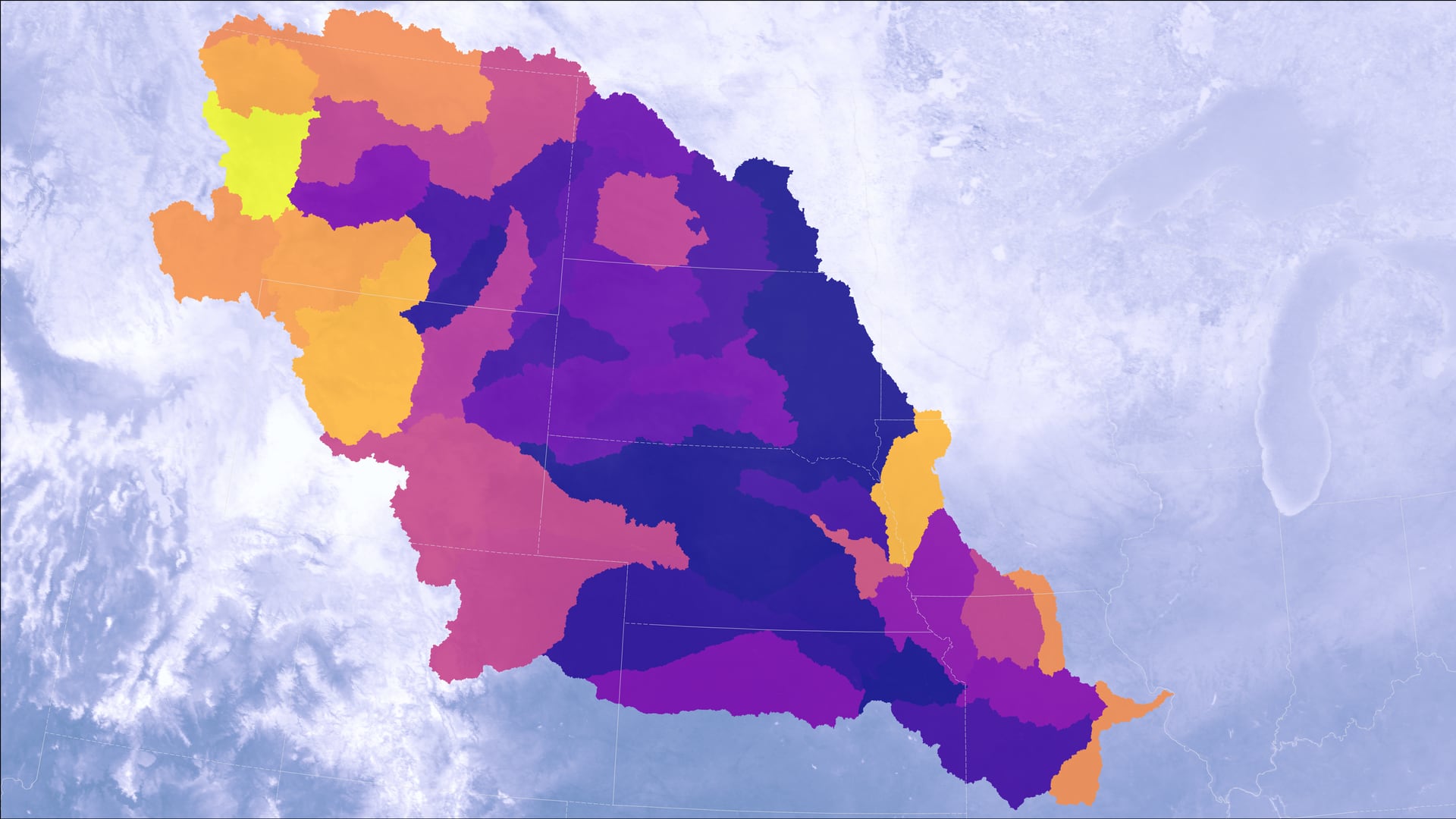
The Missouri River Basin provides irrigation water for a substantial part of the domestic agricultural sector within the United States. Drought events pose a significant threat to the economic livelihoods of dependent individuals, industries, and ecosystems (e.g. farmers, local tribes...

Principal Investigator

Hayley Pippin

Imagen
Colored Dissolved Organic Matter (CDOM) derived using Landsat 8 OLI data on January 28th, 2019 off the coast of Belize City. Darker shades of blue indicate higher levels of CDOM, while lighter blue shades show lower levels of CDOM in the coastal and inland waters. Very high levels of CDOM can inhibit photosynthesis; thus, the visualization of CDOM allows coastal management to identify regions where reef health and water quality are at risk.  Keywords: Landsat 8, CDOM, Belize

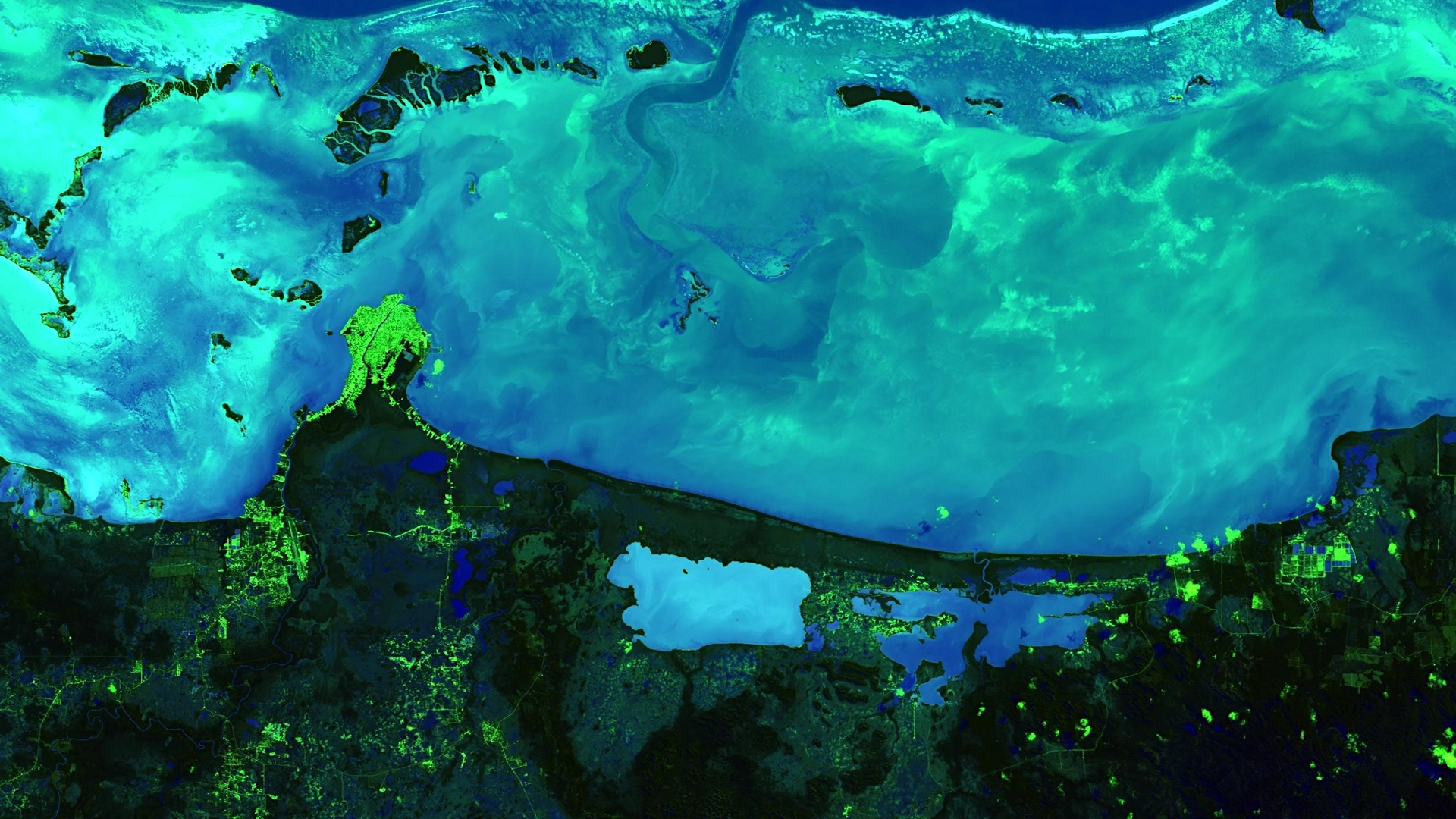
The Mesoamerican reef is a biodiverse ecosystem that stretches more than 600 miles along four Central American coasts and is the longest barrier reef in the western hemisphere. The national economies of Belize and Honduras heavily depend on the commercial...

Principal Investigator

Lilian Yang

Imagen
Developing Annual, Seasonal, and Monthly Temperature Indices over the Northeast United States to Represent Recent Temperature Trends using NASA and NOAA Datasets

Since 1977, every year has been in the top ten warmest years on record when first ranked, reflecting the upward progression of annual global temperatures. However, some years within this time frame, such as 2012, are significantly cooler than surrounding years like 2010 or 2013...

Principal Investigator

Caroline Jahn

Imagen
Development of a Snowmelt Monitoring Tool Using NASA MODIS and NOAA Climate Data Records to Aid Wildfire Managers in Alaska

Alaska is warming twice as fast as the rest of the nation due to changes in the climate, causing shorter winters, thawing permafrost, and rapidly receding glaciers. All of these weather changes are lengthening wildfire seasons and increasing the number of wildfires experienced by the...

Principal Investigator

Haley Ritger

Imagen
Early Detection of Bark Beetle Outbreaks in the Southeastern United States Using Earth Observations

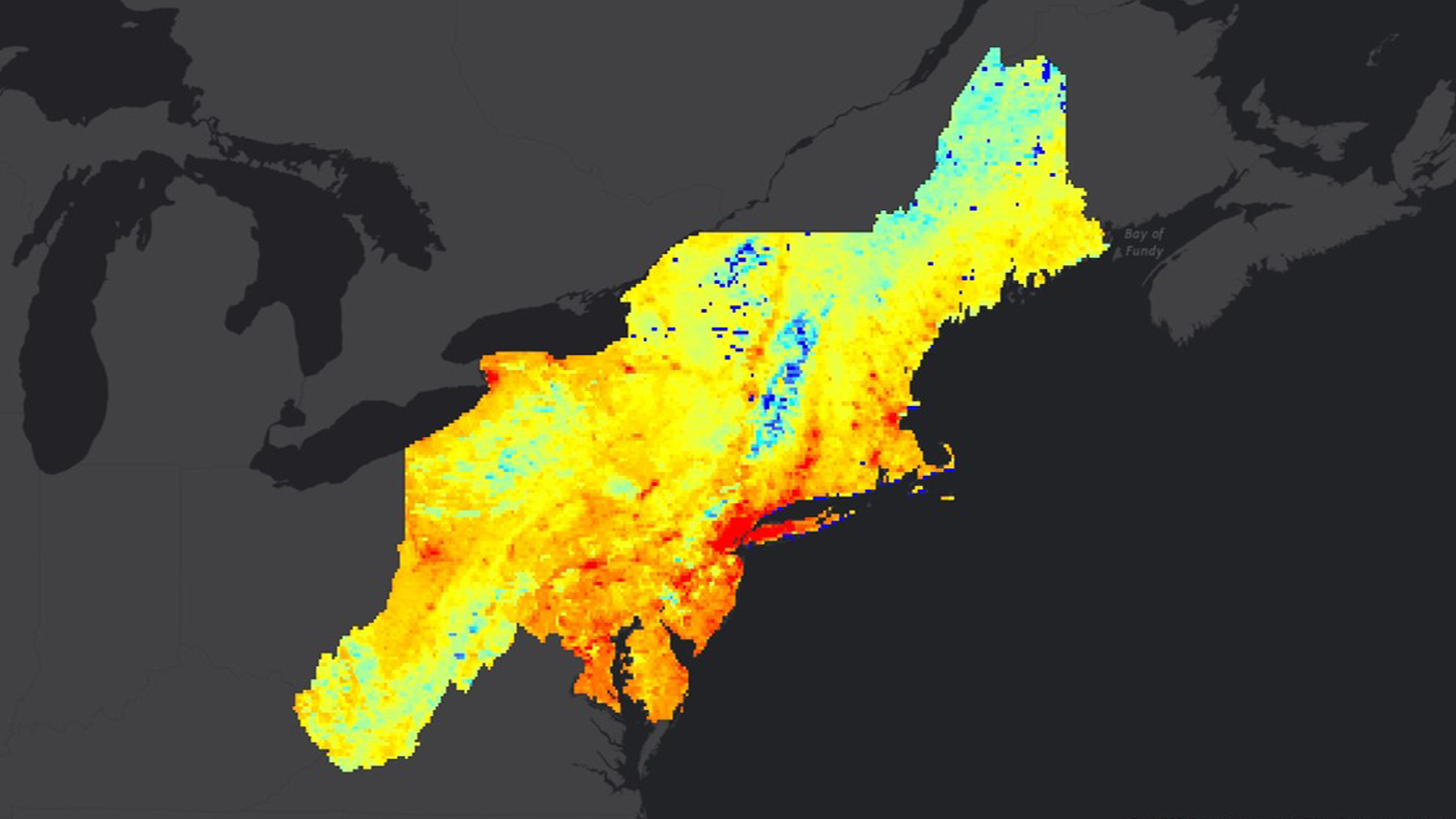
Since 2015, bark beetle infestations have increased in the southeastern United States, increasing the potential for devastating wildfires. Bark beetles infestations begin in small spots, usually by attacking a weakened or stressed focal tree. Beetles then use aggregation pheromones to increase the breeding population in...

Principal Investigator

Anastasia Kunz

Imagen
Using a Landsat 8 OLI image from September 2018, a chlorophyll-a index ((B2 - B4)/ B3) was applied over several lakes in a section of Rocky Mountain National Park. The background is NDVI combined with hillshade derived from SRTM. The dark blue within the lakes may represent higher concentrations of chlorophyll-a, a proxy for algal productivity. Utilizing remote sensing data will allow researchers to efficiently monitor water quality in lakes throughout the mountains in Colorado.

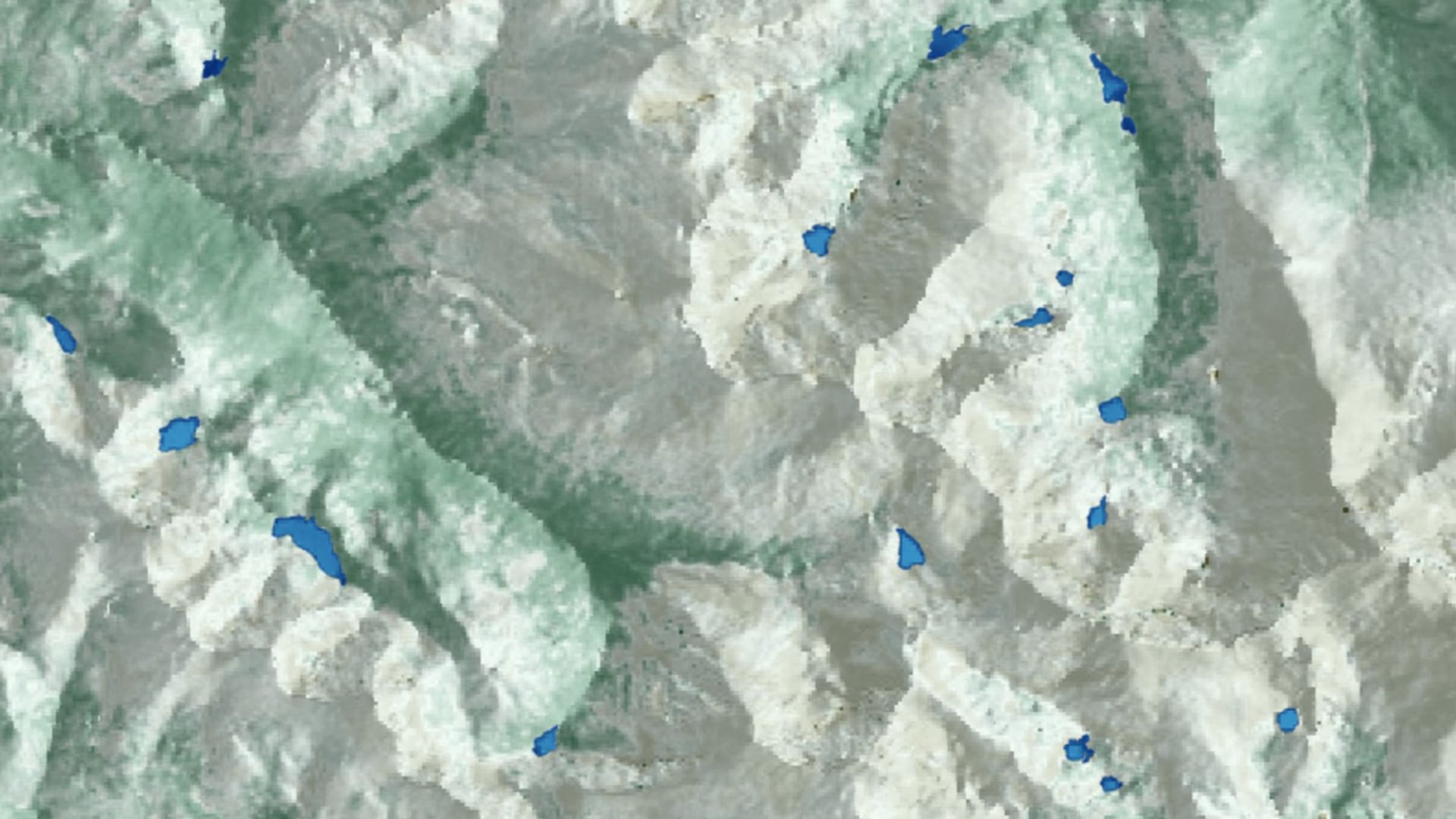
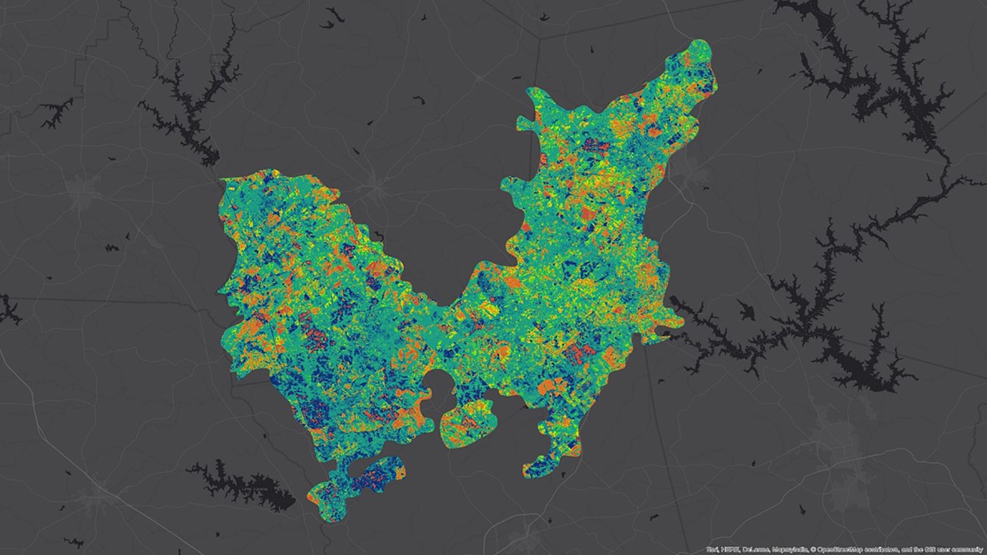
Alpine lakes in Rocky Mountain National Park (RMNP) serve as an important habitat and water source for wildlife and contribute to the overall aesthetic value of the park. However, since the 1960s, alpine lakes within RMNP have experienced intensified algal productivity as a...

Principal Investigator

Tyler Hennessee

Imagen
Derived from Aqua and Terra MODIS data, this image shows the difference between the Normalized Difference Snow Index (NDSI) in March 2017 compared to the median NDSI in March from 2000 to 2018 surrounding Lake Ontario. Light blue areas received less snow than usual, while blue areas received more. Dark blue represents bodies of water. By increasing awareness of variables that contribute to flooding (like snow cover), communities can be better prepared for flood events.

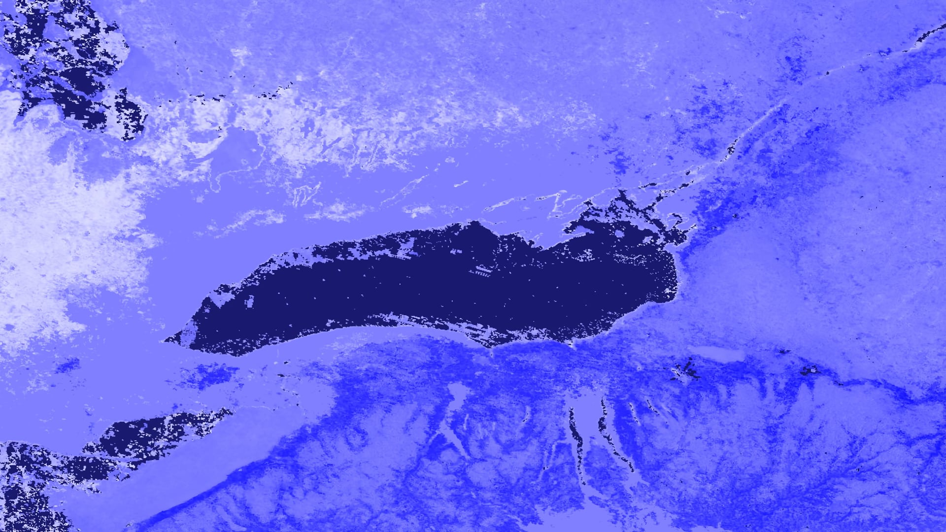
From late January through the beginning of May 2017, an extraordinary amount of precipitation fell in the Lake Ontario watershed. By late April, large swaths of the Greater Toronto Area (GTA), including numerous lakefront properties, beaches, and public recreation facilities...

Principal Investigator

Nicole Pepper

Invasive species threaten the ecological integrity of a region. Such threats have further implications that can affect regional economies and, in some cases, human health. Organizations including the National Parks Service (NPS) and the United States Geological Survey (USGS) are dedicated to the...