Image

NASA
NASA
Tasseled cap greenness transformation derived from Landsat 8 imagery over lodgepole pine forest in the Intermountain West study area
Completed Projects
Britnay Beaudry, Hayley Pippin
Team: Tasos Tentoglou (Project Lead), Eleda Fernald, Adam Weingram, David Carrasco Rivera
Summary: Initially developed by the Belize & Honduras Water Resources I/II teams, the Optical Reef and Coastal Area Assessment tool (ORCAA) is a Google Earth Engine application...
Britnay Beaudry
Team: Rachael Ross (Project Lead), Alex Posen, Shreya Suri, Stefanie Mendoza
Summary: California seeks to become a carbon neutral state by 2045. To track progress toward this goal, it is important to quantify the amount of carbon stored by various landcover types...
Adriana LeCompte
Team: Joey Lindsay (Project Lead), Keida Gaba, Lindsay Harmon, Susan Jarvis
Summary: Tonlé Sap Lake, located in Cambodia, Southeast Asia, is one of the most productive inland fisheries in the world. With the unique reverse flow...
Charlie Devine (Project Co-lead)
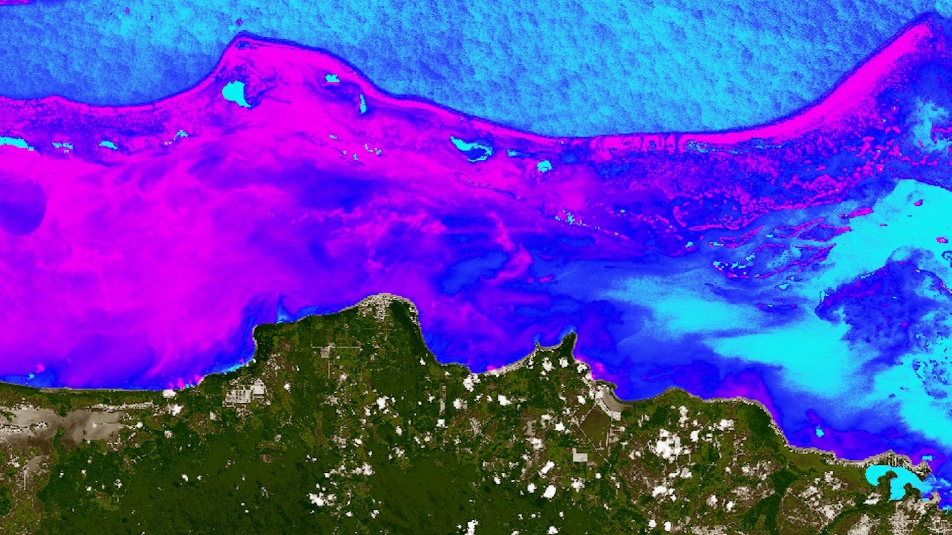
The Belize Barrier Reef is a biodiverse marine ecosystem and the largest coral reef system in the western hemisphere. The reef also provides ecosystem services in the form of fisheries and tourism and is estimated to be responsible for 12...
Vanessa Valenti

The Great Lakes Basin is one of the world’s largest freshwater ecosystems. The Basin harbors over 200,000 acres of wetlands that provide a variety of environmental, ecological, and recreational functions to over 30 million people in the region. Some of...
Krishna Sharma (Project Co-Lead)
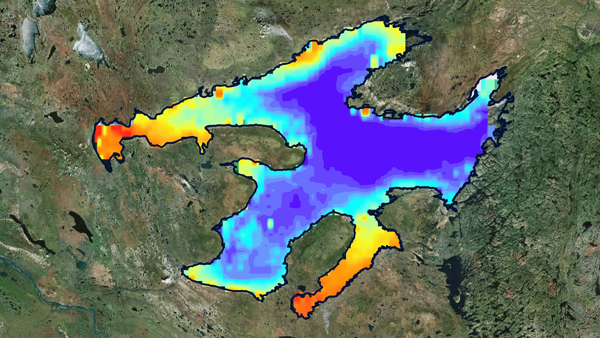
The Sahtu Dene people of Délįnę have a strong traditional tie to Great Bear Lake (GBL), which they refer to as “The Water Heart.” The indigenous community is concerned with how changes in the lake may affect their livelihoods and fisheries. Arctic lakes like the...
Neda Kasraee
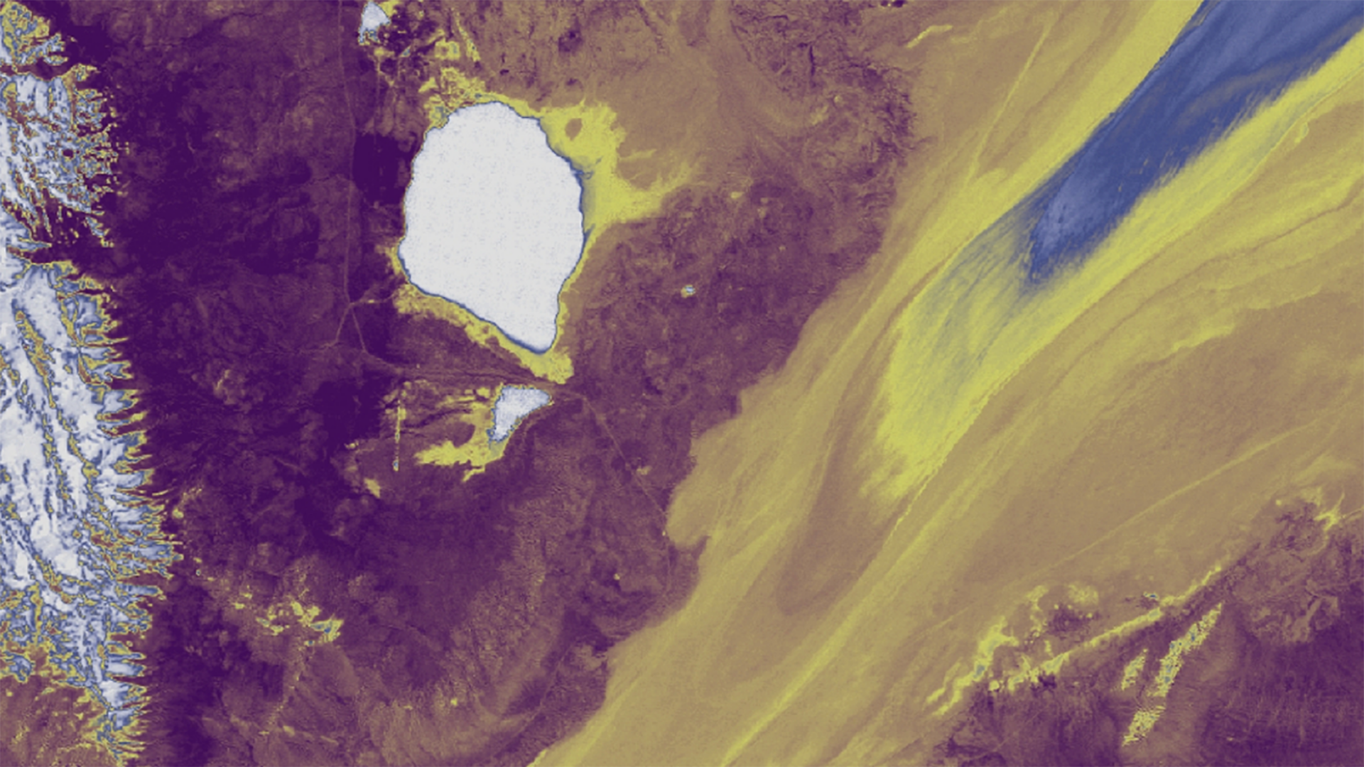
Since the early 2000s, wind-deposited sediment mounds have been growing and encroaching onto the Black Rock Playa of the Black Rock Desert-High Rock Canyon Emigrant Trails National Conservation Area. These sedimentary structures along the edge of the playa potentially increase dust emissions and alter the...
Abhishek Kumar
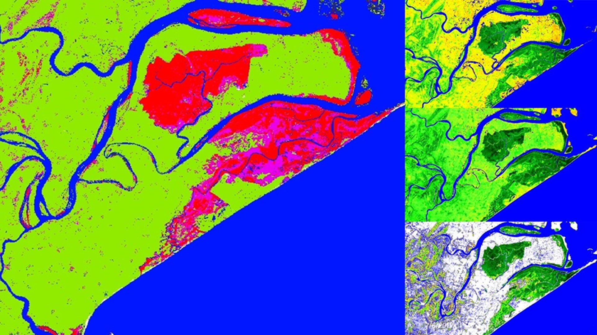
Across the globe, mangroves play a major role in coastal ecosystem processes mitigating erosion and serving as barriers against storm surges. India holds approximately 5% of the world's mangroves, over half of which are along its east coast. Situated in the state of Odisha, Chilika...
Abhishek Kumar

Mangroves, one of the most productive ecosystems on Earth, play a major role in coastal ecosystem processes, from mitigating erosion to acting as a barrier against tidal and storm surges associated with tropical cyclones. India has about 5 % of the world's mangrove vegetation...
Margaret Mulhern

The rapid expansion of human population in conjunction with industrialization has resulted in increased artificial light pollution, also known as sky glow. Anthropogenic light pollution hinders the reproductive, migratory, and predatory habits of wildlife relying on the predictable diurnal cycle. Artificial light pollution not only...