Displaying 71 - 80 of 305
![](/sites/default/files/styles/lis/public/images/develop-legacy/2021/spring/images/2021Spring_ARC_NorthernGreatPlainsDisasters_WebImage.jpg.webp?itok=-UAbylGo)
Topic
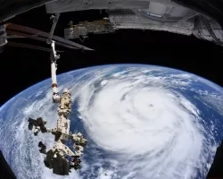
In 2019, the Great Plains experienced unprecedented catastrophic flooding. Large flood events are predicted to increase in frequency and severity, posing risks to communities in...
![](/sites/default/files/styles/lis/public/images/develop-legacy/2020/summer/images/2020Sum_JPL_AlaskaTransporation_WebsiteImage.jpg.webp?itok=b7My_tMm)
Topic
A rapidly warming Arctic has compromised the structural integrity of critical infrastructure through accelerated permafrost thaw and thermokarst development underlying these areas. Infrastructure, including roads...
![NDVI-processed imagery using Landsat 8 OLI data from June 1 to November 31, 2021. Showing Punakha, Bhutan, vegetative areas are represented by green while black depicts non-vegetative areas. Bhutan is located in the Himalayas with altitude ranging from 550 ft. to 23,000 ft., resulting in vast diversity of both ecosystem and agricultural products. Examining vegetation area help in developing a crop mask and remotely sensed data collection protocol for rice in Bhutan.](/sites/default/files/styles/lis/public/2022-03/2021Fall_MSFC_BhutanAg_WebsiteImage.png.webp?itok=z2epU4rN)
Bhutan Agriculture (Fall 2021) Team: Yeshey Seldon (Project Lead), Kusal Khandal, Sherab Dolma, and Wangdrak Dorji Summary: Rice cultivation in Bhutan has been increasingly threatened...
Topic
Fire managers will soon have ready access to weather and fire models to predict the behavior of fires whose locations are known. The models result...
![The satellite imagery is a Sentinel-1 Ground Range Detection C-SAR image from July 2nd, 2021, taken over the Sudd Wetland located in South Sudan. The image shows the 'VV' backscatter values, which correlate to vertical transmission and vertical reception from the C-SAR instrument and are used to classify wetland inundation extent. Low 'VV' values (blue) represent areas covered by open waters & inundated land areas and high 'VV' values (yellow) represent dry land areas.](/sites/default/files/styles/lis/public/2023-05/2023Spring_JPL_WETWater_WebsiteImage.jpg.webp?itok=UViLBf_D)
Topic
WET Water Resources (2023 Spring) Team: Lori Berberian (Project Lead), Kaely Harris, Mitch Porter, Emma Waugh Summary: Wetland ecosystems are annually or seasonally wet transition...
![NDVI processed imagery from Landsat 9 Collection 2 Tier 1 TOA Reflectance for the whole year of 2022. The composite image shows the vegetation landscape of western Bhutan, focused on the districts of Punakha, Paro, and Wandgue Phodrang. The band combinations highlight forest cover in green, paddy fields in light brown, waterbodies in gray, and barren lands and settlements in black.](/sites/default/files/styles/lis/public/2024-01/2023Sum_MSFC_BhutanAgIII_WebsiteImage.jpg.webp?itok=DlIoUvUN)
Topic
Bhutan Agriculture III (Summer 2023) Team: Sonam Seldon Tshering (Project Lead), Garab Kuenphen Dorji, Ugyen Thinley Dorji, Sangay Choden, Tenzin Lhaden Summary: The Bhutan Agriculture...
![](/sites/default/files/styles/lis/public/images/develop-legacy/2021/spring/images/2021Spring_LaRC_FairfaxCountyWaterResources.jpg.webp?itok=yrcSvwPP)
Topic
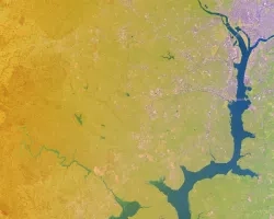
Between 2000 and 2020, Fairfax County, Virginia experienced extreme weather events that caused severe flooding and degradation of roads, businesses, and other public property. A...
![False-color imagery from Landsat 8 surface reflectance. The 2021 median composite image depicts the landscape and vegetation sites in the regions of western Bhutan, specifically the districts of Punakha, Wangdue Phodrang, Thimphu, and Paro. The band combination highlights fallow agriculture fields in light brown, dense urban areas in purple, forest cover in green, snow in light blue, and rocky areas in darker brown.](/sites/default/files/styles/lis/public/2022-12/2022Sum_MSFC_BhutanAgII_WebsiteImage.png.webp?itok=T2Ky1XPH)
Bhutan Agriculture II (Summer 2022) Team: Wangdrak Dorji (Project Co-Lead), Tenzin Wangmo (Project Co-Lead), Karma Dorjee, Sonam S Tshering Summary: Agriculture is an essential sector...
![](/sites/default/files/styles/lis/public/images/develop-legacy/2020/fall/images/2020Fall_JPL_CentralValleyIIWater_WebsiteImage.jpg.webp?itok=jTxcQlyP)
Topic
California’s Central Valley is one of the most productive agricultural regions in the United States, producing a fourth of the nation’s food supply. The water...
![](/sites/default/files/styles/lis/public/Ida-ISS-Aug-30-2021.jpg.webp?itok=1OWcMy5q)