Displaying 41 - 50 of 120
![Normalized Difference Moisture Index (NDMI) processed 2021 Landsat 8 OLI imagery over land and Sentinel-2 MSI over ocean, ranging from yellow (low) to blue (high), for Hilo, Hawaii. Overlayed with four-day rainfall accumulation cells in blue acquired during Hurricane Lane (Aug 22-25, 2018) from CHIRPS Daily. NDMI monitors water content of leaves and is useful for classifying land cover. Impervious surfaces and areas that have received excessive historical rainfall are susceptible to future flood events.](/sites/default/files/styles/lis/public/2022-03/2021Fall_AZ_HawaiiIslandDisasters_WebsiteImage_1440.png.webp?itok=UF3NMIoI)
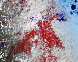
Hawai‘i Island Disasters (Fall 2021) Team: Garren Kalter (Project Lead), Rose Eichelmann, Sanketa Kadam, Erin Azuma, and Anna Mikkelsen Summary: As the County of Hawai‘i...
Topic
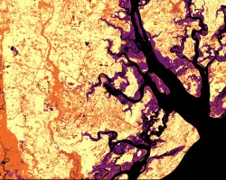
Nearly a quarter of California's fresh water supply flows through the Sacramento-San Joaquin Delta, an area comprised of tidal marshland and reclaimed land in the...
![2022 Spring PUP Mexico Disasters Website Image](/sites/default/files/styles/lis/public/2022-06/2022Spring_PUP_MexicoDisasters_WebsiteImage_v2.png.webp?itok=3ZfxI279)
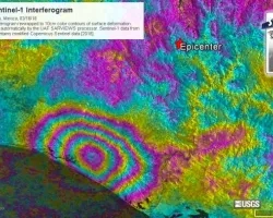
Mexico Disasters (Spring 2022) Team: Philip Casey (Project Lead), John Willis, Sean Nelsen, Zachary Silberman Summary: In this project, NASA DEVELOP partnered with Mexico’s National...
![Normalized Difference Water Index (NDWI) to visualize drainage networks around the Unalakleet River in Alaska, calculated from an August 2021 Landsat 8 OLI image. Yellow represents standing or flowing water and potential flood zones, while the dark blue represents drier, upland regions. Unalakleet's climate resilience planning prioritizes relocation to upland regions while avoiding areas that have experienced significant permafrost degradation.](/sites/default/files/styles/lis/public/2023-10/2023Sum_GA_UnalakleetClimate_WebsiteImage.jpg.webp?itok=9m9RUwoB)
Unalakleet Climate (Summer 2023) Team: Ian Lee (Project Lead), Clara Maxwell, Daniel J. Marsden, M. Jaweed Nazary Summary: The coastal community of Unalakleet is currently...
![The image was collected by Landsat 9 on January 26 of 2023 showing Skidaway Island and waterways on the Georgia coast. The data shows areas of healthy vegetation and urban areas using a Normalized Difference Vegetation Index (NDVI). The darker orange represents grass and urban areas. Yellow and purple represents forested and densely vegetated areas. The black represents open water.](/sites/default/files/styles/lis/public/2023-05/2023Spring_GA_GeorgiaDisastersII_WebsiteImage.jpg.webp?itok=zhMhpiSz)
Georgia Disasters II (2023 Spring) Team: Shakirah Rogers (Project Lead), Nathan Tesfayi, Matthew Murray, Clarence Jackson Summary: Heirs property owners are especially vulnerable to natural...
![NDWI-processed imagery from Landsat 8 Operational Land Imager data. This mosaicked image was taken from January to December 2021 of Jekyll Island, Georgia. NDWI contrasts the water features in a satellite image to its surroundings by measuring the moisture content. Low moisture content is shown in white, and high moisture content is shown in blue.](/sites/default/files/styles/lis/public/2023-02/2022Fall_GA_Disasters_WebsiteImage.png.webp?itok=_4Frkxe1)
Georgia Disasters (Fall 2022) Team: Isabella Chittumuri (Project Lead), Nancee Uniyal, Nathan Tesfayi, Shakirah Rogers Summary: In September 2017, Hurricane Irma made landfall in southern...