Image

NASA
NASA
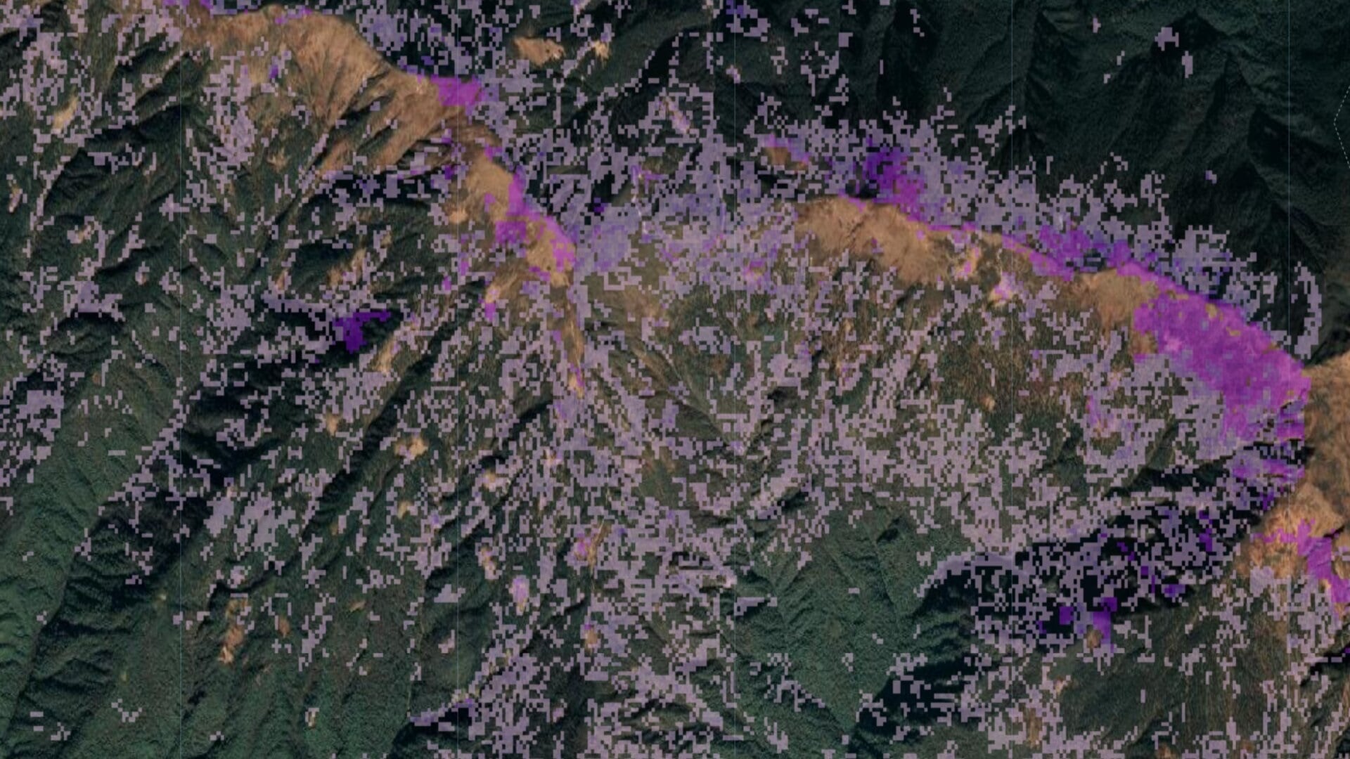
Tasseled cap greenness transformation derived from Landsat 8 imagery over lodgepole pine forest in the Intermountain West study area
Completed Projects
Krishna Sharma (Project Co-Lead)
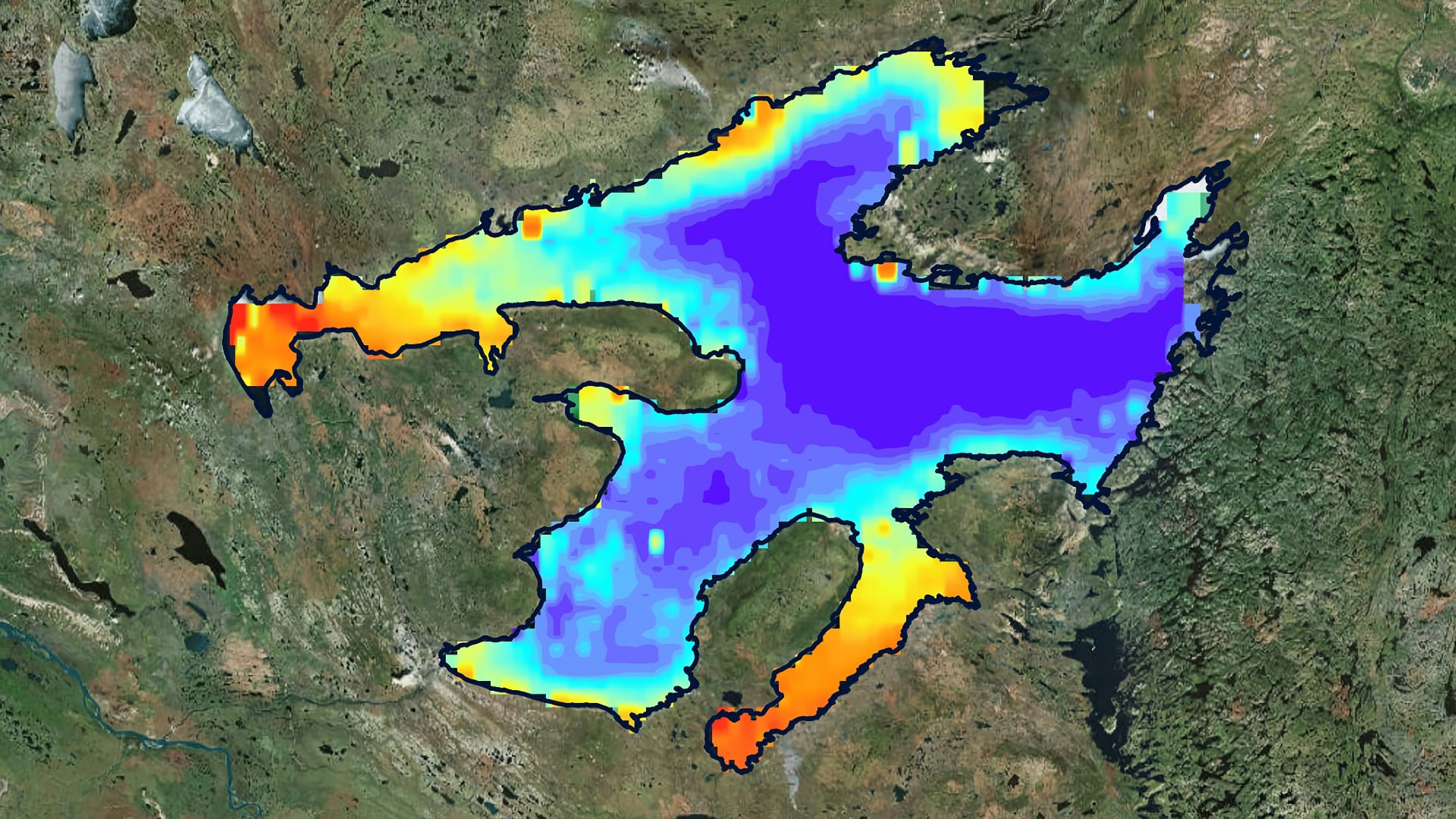
The Sahtu Dene people of Délįnę have a strong traditional tie to Great Bear Lake (GBL), which they refer to as “The Water Heart.” The indigenous community is concerned with how changes in the lake may affect their livelihoods and fisheries. Arctic lakes like the...
Neda Kasraee
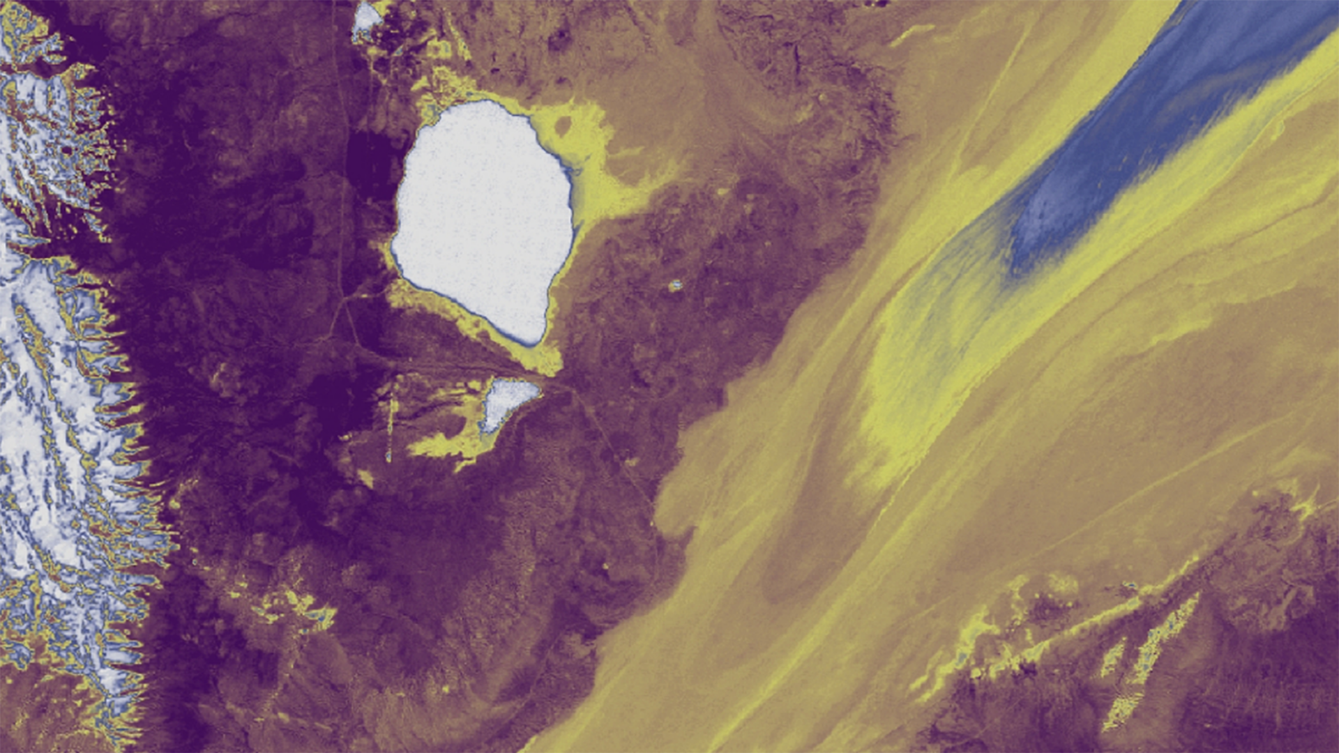
Since the early 2000s, wind-deposited sediment mounds have been growing and encroaching onto the Black Rock Playa of the Black Rock Desert-High Rock Canyon Emigrant Trails National Conservation Area. These sedimentary structures along the edge of the playa potentially increase dust emissions and alter the...
Abhishek Kumar

Mangroves, one of the most productive ecosystems on Earth, play a major role in coastal ecosystem processes, from mitigating erosion to acting as a barrier against tidal and storm surges associated with tropical cyclones. India has about 5 % of the world's mangrove vegetation...
Abhishek Kumar
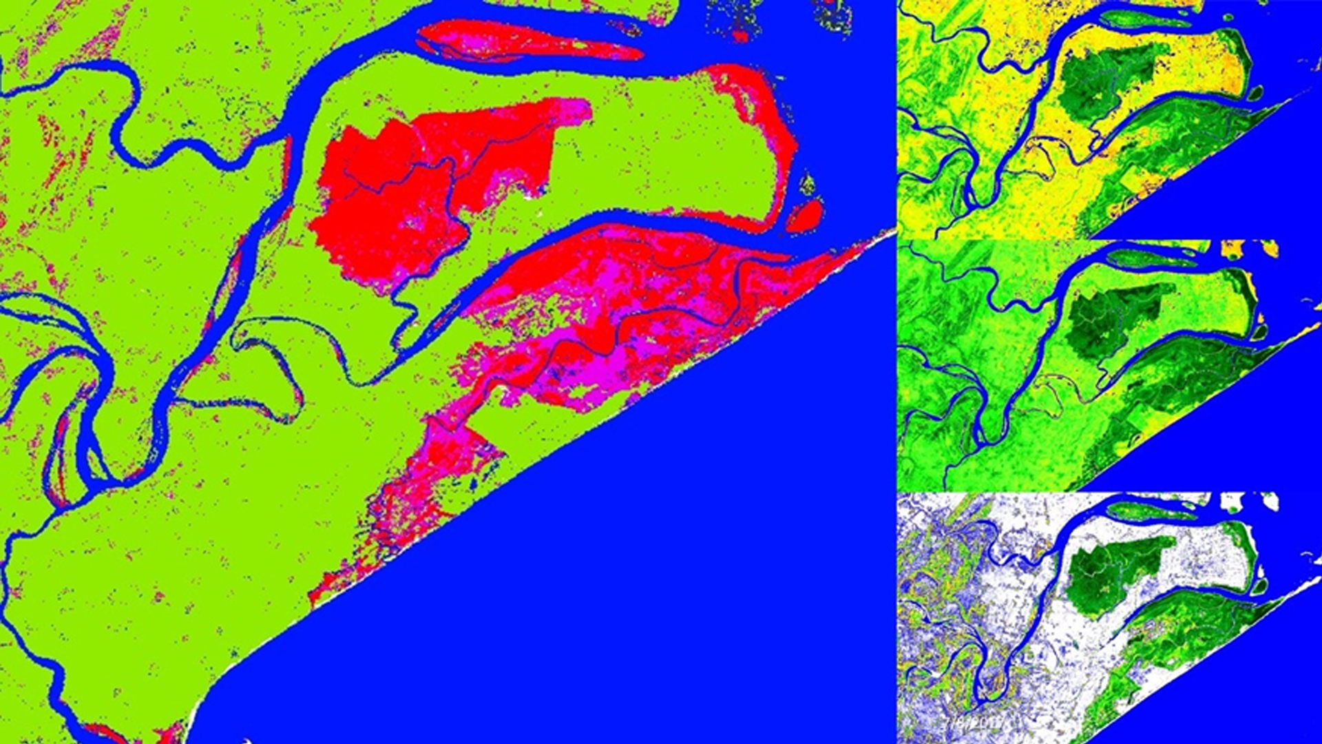
Across the globe, mangroves play a major role in coastal ecosystem processes mitigating erosion and serving as barriers against storm surges. India holds approximately 5% of the world's mangroves, over half of which are along its east coast. Situated in the state of Odisha, Chilika...
Margaret Mulhern
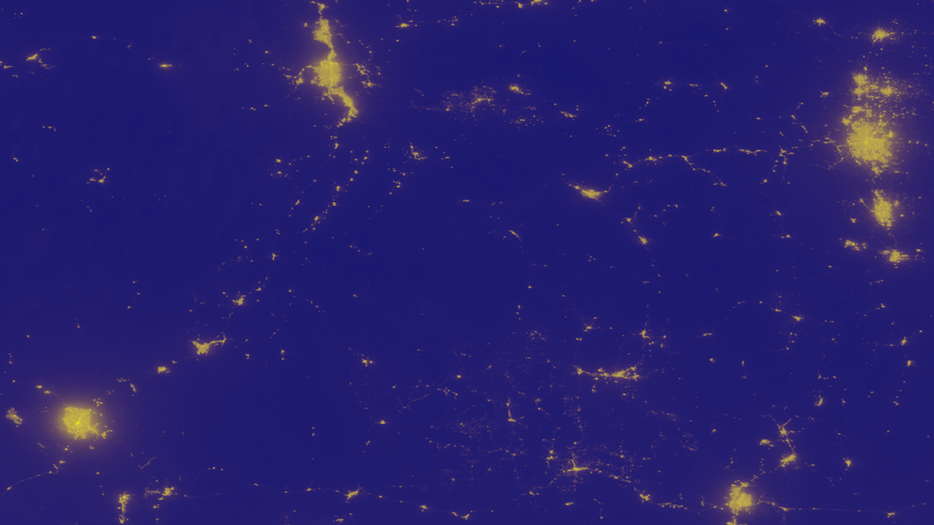
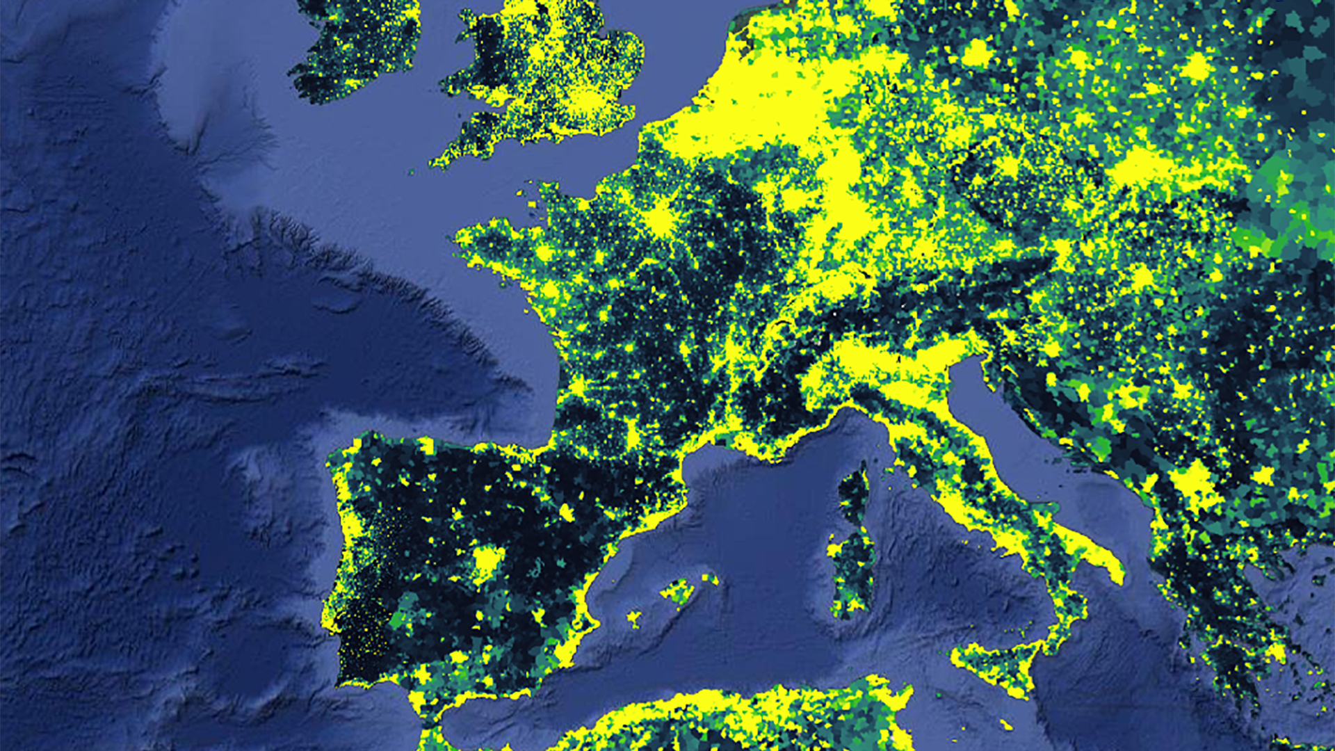
The rapid expansion of human population in conjunction with industrialization has resulted in increased artificial light pollution, also known as sky glow. Anthropogenic light pollution hinders the reproductive, migratory, and predatory habits of wildlife relying on the predictable diurnal cycle. Artificial light pollution not only...
Gia Mancini
Vector-borne diseases, caused by pathogens and parasites, are transmitted through living organism carriers known as vectors. Mosquitoes are the most common disease vectors and transmit illnesses such as Zika, West Nile, chikungunya, malaria, dengue, and yellow fever. These diseases affect millions of people around the...
Chris Ploetz
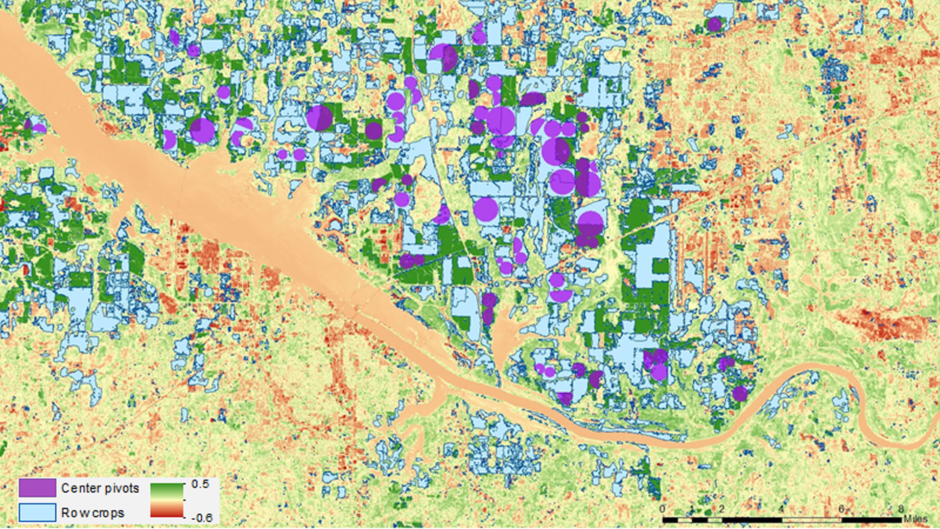
Drought in Alabama has a major impact on agriculture, causing crop yields to fall well below their normal numbers throughout the state. This project researched drought conditions experienced in 2012 and 2016 and the impact the conditions had on corn production. The Alabama Office...
Charlotte Mays
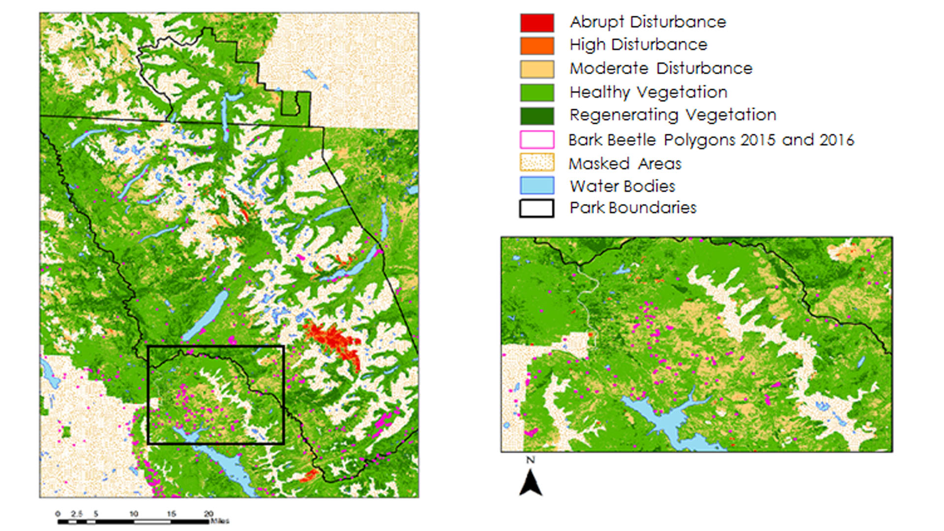
Insects and pathogens cause extensive damage to pine forests in the northwestern United States. Bark beetles in particular cause mortality in pine stands that can impact the timber industry and national parks. Previously, studies have used spectral indices derived from Landsat time series to...
Anna Stamatogiannakis
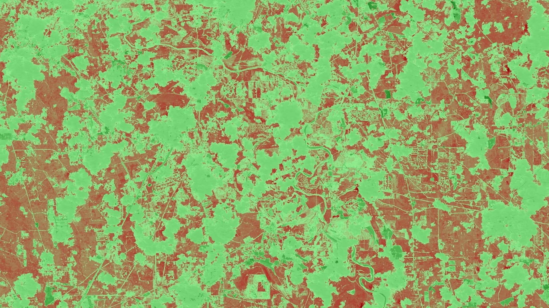
In 2011, Texas experienced a severe drought that caused substantial economic and environmental losses. The Texas A&M Forest Service (TFS) estimated that 300 million trees succumbed to the severe drought conditions, with urban areas, in particular, losing about 5.6 million...
Tashi Choden
Forest disturbances from bark beetle outbreaks are a major concern in Bhutan, known to cause extensive tree mortality to pine and spruce forests. The NASA DEVELOP team partnered with the Ugyen Wangchuck Institute of Conservation and Environmental Research (UWICER), the...