Displaying 3351 - 3360 of 3650
Affiliation
NASA Marshall Space Flight Center
Program Role
Associate Program Manager, Water Resources and Agriculture
Christopher Hain is an Associate Program Manager in the Water Resources and Agriculture Application Areas.
Affiliation
NASA Headquarters
Program Role
Program Coordinator, Agriculture
Cordelia Hiers Brady is the Program Coordinator for NASA’s Applied Sciences agriculture application area.
Capacity Building
Ecological Conservation
Water Resources
![NDTI-processed river imagery from 2021 PlanetScope data with GPM IMERG data shown in blue. The Shoshone River in northwestern Wyoming is shown with red values indicating lower turbidity and yellow values representing higher turbidity. Lighter blue values indicate higher monthly mean IMERG precipitation values for 2021. NDTI values and precipitation averages help watershed managers understand where and when excess sediment enters the river.](/sites/default/files/styles/lis/public/2023-02/2022Fall_PUP_ShoshoneRiverWater_WebsiteImage.jpg.webp?itok=myaPr9UA)
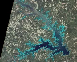
Shoshone River Water Resources (Fall 2022) Team: Robyn Holmes (Project Lead), Will Campbell, Cassie Ferrante, Nelson Lemnyuy Summary: In 2016, a routine repair operation at...
![Fall 2022 Maldives Climate](/sites/default/files/styles/lis/public/2023-02/2022Fall_ARC_MaldivesClimate_WebsiteImage.jpg.webp?itok=6Go_gwk1)
Topic
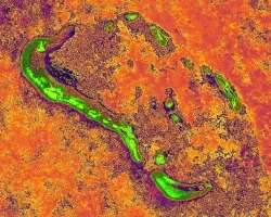
Maldives Climate (Fall 2022) Team: Aidan Harvey (Project Lead), Daniel Lopez, Mitch Porter, Derek Chin Summary: Global sea level rise as a result of climate...
![Land cover imagery processed from Landsat 8 OLI and ocean turbidity data imagery processed from Sentinel-2 MSI. The Tijuana River stormwater plume off the San Diego coast was mapped from data collected on December 5th, 2019, while the land surface data was collected on April 4th, 2022. Shades of red indicate high turbidity values, while blue areas show normal turbidity values. Areas of high turbidity reflect high concentration of pollutants from stormwater runoff.](/sites/default/files/styles/lis/public/2023-02/2022Fall_ARC_SanDiegoWaterResources_WebsiteImage.jpg.webp?itok=Z3fy2AmA)
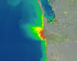
San Diego Water Resources (FALL 2022) Team: Ethan Gates (Project Lead), Stefanie Mendoza, Jonathan Szeto, Max VanArnam Summary: Stormwater and wastewater runoff are a large...
![NDVI imagery derived from Landsat 8 OLI data. This imagery showing the California’s Carmel and Salinas Valleys within the surrounding Santa Lucia Mountain range was collected in the Spring of 2019 . Light green areas show the more developed, agriculturally intensive areas of the valley while the dark blue areas show the less developed hills. NDVI calculations were used in models of forest cover changes in the area over time.](/sites/default/files/styles/lis/public/2023-02/2022Fall_CO_CarmelValleyEcoForecasting_WebsiteImage.jpg.webp?itok=AwlUPU2s)
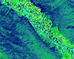
Carmel Valley Urban Development (Fall 2022) Team: Cooper Campbell (Project Lead), Julia Portmann, Devina Garcia, Audrey Wilson Summary: Urban expansion in diverse ecosystems has numerous...
![Annual max biomass calculated from 2021 daily Harmonized LandSat Sentinel-2 (HLS) dataset. Dark purple colors show low biomass while the bright orange show high biomass. Regions with high vegetation and tree canopy cover are shown in orange on the left of the image. High biomass values are of an interest to rangeland managers to help inform their grazing decisions based on which areas of the ranch produce the most biomass/vegetation.](/sites/default/files/styles/lis/public/2023-02/2022Fall_CO_EasternPlainsAgr_WebsiteImage.jpg.webp?itok=StO3rYYa)
Eastern Plains Agriculture (Fall 2022) Team: Jillian Joubert, Sarah Hettema, Deni Ranguelova, TR Ingram, Max Stewart Summary: Adaptive management on cattle ranches requires rangeland managers...
![NDWI-processed imagery from Landsat 8 Operational Land Imager data. This mosaicked image was taken from January to December 2021 of Jekyll Island, Georgia. NDWI contrasts the water features in a satellite image to its surroundings by measuring the moisture content. Low moisture content is shown in white, and high moisture content is shown in blue.](/sites/default/files/styles/lis/public/2023-02/2022Fall_GA_Disasters_WebsiteImage.png.webp?itok=_4Frkxe1)
Georgia Disasters (Fall 2022) Team: Isabella Chittumuri (Project Lead), Nancee Uniyal, Nathan Tesfayi, Shakirah Rogers Summary: In September 2017, Hurricane Irma made landfall in southern...