Displaying 141 - 150 of 305
![2022 Spring PUP Mexico Disasters Website Image](/sites/default/files/styles/lis/public/2022-06/2022Spring_PUP_MexicoDisasters_WebsiteImage_v2.png.webp?itok=3ZfxI279)
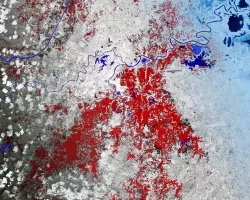
Mexico Disasters (Spring 2022) Team: Philip Casey (Project Lead), John Willis, Sean Nelsen, Zachary Silberman Summary: In this project, NASA DEVELOP partnered with Mexico’s National...
![](/sites/default/files/styles/lis/public/images/develop-legacy/2021/spring/images/2021Spring_JPL_CCWR_WebsiteImage_V3.jpg.webp?itok=YZI9AtzT)
Topic
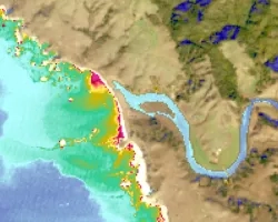
Estuaries are vital ecosystems that serve important ecological functions. The Marine Life Protection Act aims to protect these ecosystems by establishing a network of marine...
![Hurricane Isaias traveling northwest between Cuba and the Bahamas on Friday, July 31, 2020, as seen from the International Space Station. Credits: NASA/Astronaut Col. Doug Hurley](/sites/default/files/styles/lis/public/2020-08/isaias_astronaut.jpg.webp?itok=6vi0Xof4)
![](/sites/default/files/styles/lis/public/images/develop-legacy/2019/summer/images/2019Sum_AL_MobileUrban_WebsiteImage.jpg.webp?itok=581tgURE)
Topic
This project utilized satellite Earth observations to assess locations in Mobile County, Alabama, that are vulnerable to the urban heat island effect (UHI) and flood...
![NDVI over Mato Grosso, Brazil processed from March 2021 Landsat-8 OLI data. Calculated NDVI values correspond with colors shown to indicate plant health. High NDVI values (green to blue) indicate dense vegetation found in tropical and temperate forests or crops at their peak growth. Low values (yellow to red) depict barren land, water, and moisture-stressed vegetation. These data can support timely and efficient agricultural responses to ensure productive yields and food security.](/sites/default/files/styles/lis/public/2022-12/2022Sum_NC_MatoGrosso_WebsiteImage_FD.png.webp?itok=JJA3kKJi)
Mato Grosso Agriculture (Summer 2022) Team: Max Rock (Project Lead), Elijah Dalton, Aidan Harvey, Kate Reynolds Summary: Ranked as the fourth largest food producer in...
Topic
SPARROW is widely used throughout the United States for long term, steady state water quality analysis. However, users are increasingly asking for a dynamic version...
![](/sites/default/files/styles/lis/public/images/develop-legacy/2019/summer/images/2019Sum_MSFC_CentralAmericaTI_WebsiteImage.jpg.webp?itok=DWQOzdqL)
Topic
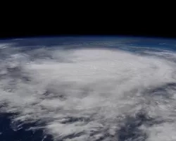
Central America is one of the world’s most vulnerable regions to natural disasters, including landslides and precipitation-driven flooding. In an effort to support disaster management...
![NDWI-processed composite image from Landsat 8 OLI data of the Lower Illinois River Valley and surrounding landscapes from summer 2021. Shades of pale yellow indicate dry vegetation and dark teal represents open water, while brighter turquois values depict wet vegetation. Areas of high NDWI values are demonstrative of high presence of wet vegetation and are of interest to the Great Rivers Land Trust in identifying areas of interest for wetland conservation.](/sites/default/files/styles/lis/public/2022-12/2022Sum_JPL_LowerIllinoisEco_WebsiteImage.png.webp?itok=eCvz2h8C)
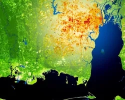
Lower Illinois River Valley Ecological Forecasting (Summer 2022) Team: Vanessa Machuca (Project Lead), Dana Myers, Hannah Rigdon, Christiana Saldana Summary: The Lower Illinois River Valley...